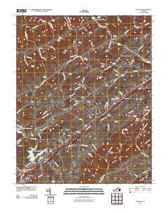
2010 Map of Wyndale
USGS Topo · Published 2010About this map
Abingdon and the neighboring hills of Washington County are shown here in the modern era, revealing a landscape defined by interstate corridors and established rural communities. The map depicts the expansion of residential developments like Hilander Park, Evergreen Hills, and Preston Hills alongside long-standing geography such as Rich Mountain and Walker Mountain. This 2010 survey illustrates the prominence of the Virginia Highlands Airport and the complex water management systems of Beaver Creek Impoundment and Clear Creek Lake, which serve the growing population centers. Dozens of small family and community burial grounds, including the Denton Cemetery, Tate Cemetery, and Sutton Cemetery, are meticulously marked across the ridges and hollows, serving as vital anchor points for genealogists tracing regional lineages. The transition from the dense streets of Bristol in the southwest to the rural reaches of Wyndale and Greendale showcases the enduring balance between southwestern Virginia’s developing infrastructure and its agricultural roots.
Find a feature on this map
119 named features on this map. Tap any name to fly to it.
Don’t see what you’re looking for? This feature index may not catch every label — zoom into the map to look around manually.
Map Details
Editions of this 2010 Wyndale Map
This is the sole edition of this map. No revisions or reprints were ever made.
Other maps of this area

1891 · Abingdon
USGS Topo · 1:125,000

1894 · Abingdon
USGS Topo · 1:125,000

1897 · Bristol
USGS Topo · 1:125,000

1902 · Bristol
USGS Topo · 1:125,000

1909 · Abingdon
USGS Topo · 1:96,000

1911 · Abingdon
USGS Topo · 1:125,000

1918 · Carterton
USGS Topo · 1:62,500

1934 · Wallace
USGS Topo · 1:24,000

1934 · Holston Valley
USGS Topo · 1:24,000

1934 · Brumley
USGS Topo · 1:24,000