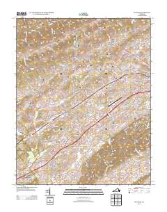
2013 Map of Wyndale
USGS Topo · Published 2013About this map
Virginia Highlands Airport sits as a central hub in this landscape, surrounded by a network of established residential and industrial developments. The map reveals a cluster of named subdivisions and communities including Wyndale, Hilander Park, and Evergreen Hills that follow the transport corridor southwest of Abingdon. The rural character of the region is grounded by features like the Green Valley Poultry Farm and the complex topography of Ratcliff Knob and Puckett Knob.
Find a feature on this map
194 named features on this map. Tap any name to fly to it.
Don’t see what you’re looking for? This feature index may not catch every label — zoom into the map to look around manually.
Map Details
Editions of this 2013 Wyndale Map
This is the sole edition of this map. No revisions or reprints were ever made.
Other maps of this area

1891 · Abingdon
USGS Topo · 1:125,000

1894 · Abingdon
USGS Topo · 1:125,000

1897 · Bristol
USGS Topo · 1:125,000

1902 · Bristol
USGS Topo · 1:125,000

1909 · Abingdon
USGS Topo · 1:96,000

1911 · Abingdon
USGS Topo · 1:125,000

1918 · Carterton
USGS Topo · 1:62,500

1934 · Wallace
USGS Topo · 1:24,000

1934 · Holston Valley
USGS Topo · 1:24,000

1934 · Brumley
USGS Topo · 1:24,000