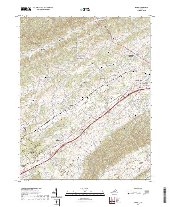
2022 Map of Wyndale
USGS Topo · Published 2022About this map
Wyndale and Greendale anchor the northern landscape of this Virginia survey, where the rolling valleys between Walker Mtn and the Great Knobs are characterized by a dense network of family-owned land and small rural communities. The map captures the suburban and educational expansion of the Abingdon area, notably featuring the Virginia Highlands Community College and the Southwest Virginia Higher Education Center. Transportation and commerce are centered along the primary corridors leading toward Bristol, with the Virginia Highlands Airport serving as a regional landmark. Numerous small burial grounds, such as the Saint John Cem, Clyce Cem, and Tate Cem, are scattered throughout the ridges and hollows like Rust Hollow and Stillhouse Hollow, offering significant detail for genealogists tracking the deep roots of families in the Holston Valley.
Find a feature on this map
192 named features on this map. Tap any name to fly to it.
Don’t see what you’re looking for? This feature index may not catch every label — zoom into the map to look around manually.
Map Details
Editions of this 2022 Wyndale Map
This is the sole edition of this map. No revisions or reprints were ever made.
Other maps of this area

1891 · Abingdon
USGS Topo · 1:125,000

1894 · Abingdon
USGS Topo · 1:125,000

1897 · Bristol
USGS Topo · 1:125,000

1902 · Bristol
USGS Topo · 1:125,000

1909 · Abingdon
USGS Topo · 1:96,000

1911 · Abingdon
USGS Topo · 1:125,000

1918 · Carterton
USGS Topo · 1:62,500

1934 · Wallace
USGS Topo · 1:24,000

1934 · Holston Valley
USGS Topo · 1:24,000

1934 · Brumley
USGS Topo · 1:24,000