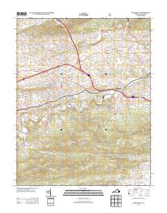
2013 Map of Wytheville
USGS Topo · Published 2013About this map
Wytheville serves as the central hub of this 2013 topographic study, where the intersection of Interstate 77 and Interstate 81 overlays a deeper history of local thoroughfares like Old Stage Rd and the Grayson Tpke. The landscape is defined by the sharp contrast between the urban grid of the county seat and the formidable terrain of the Blue Ridge, with Lick Mountain and Stuart Mountain dominating the southern half of the quadrangle.
Find a feature on this map
83 named features on this map. Tap any name to fly to it.
Don’t see what you’re looking for? This feature index may not catch every label — zoom into the map to look around manually.
Map Details
Editions of this 2013 Wytheville Map
This is the sole edition of this map. No revisions or reprints were ever made.
Other maps of this area

1887 · Pocahontas
USGS Topo · 1:125,000

1889 · Hillsville
USGS Topo · 1:125,000

1889 · Wytheville
USGS Topo · 1:125,000

1890 · Dublin
USGS Topo · 1:125,000

1891 · Pocahontas
USGS Topo · 1:125,000

1891 · Dublin
USGS Topo · 1:125,000

1892 · Hillsville
USGS Topo · 1:125,000

1892 · Wytheville
USGS Topo · 1:125,000

1894 · Pocahontas
USGS Topo · 1:125,000

1895 · Pocahontas
USGS Topo · 1:125,000