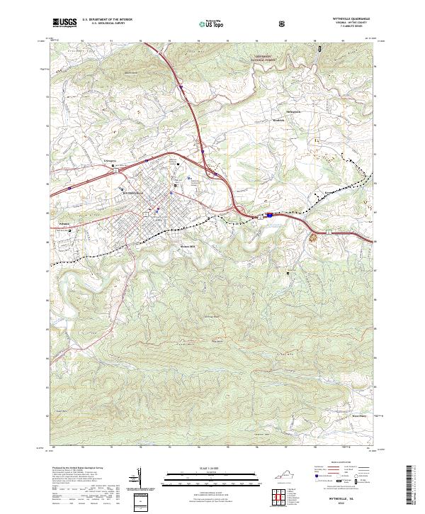
2022 Map of Wytheville
USGS Topo · Published 2022About this map
Wytheville serves as the central hub of this southwestern Virginia landscape, where the Norfolk Southern railroad and major modern thoroughfares intersect. The town’s civic and educational identity is established by the Wytheville Community College and the Wythe County Circuit Court Building, while several large burial grounds like East End Cem and West End Cem offer significant points of interest for genealogical research. Surrounding the urban center, the terrain is defined by prominent ridges including Cove Mtn, Sand Mtn, and Lick Mtn.
Find a feature on this map
160 named features on this map. Tap any name to fly to it.
Don’t see what you’re looking for? This feature index may not catch every label — zoom into the map to look around manually.
Map Details
Editions of this 2022 Wytheville Map
This is the sole edition of this map. No revisions or reprints were ever made.
Other maps of this area

1887 · Pocahontas
USGS Topo · 1:125,000

1889 · Hillsville
USGS Topo · 1:125,000

1889 · Wytheville
USGS Topo · 1:125,000

1890 · Dublin
USGS Topo · 1:125,000

1891 · Pocahontas
USGS Topo · 1:125,000

1891 · Dublin
USGS Topo · 1:125,000

1892 · Hillsville
USGS Topo · 1:125,000

1892 · Wytheville
USGS Topo · 1:125,000

1894 · Pocahontas
USGS Topo · 1:125,000

1895 · Pocahontas
USGS Topo · 1:125,000