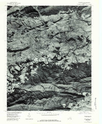
1976 Map of Wytheville
USGS Topo · Published 1983About this map
Wytheville serves as the focal point of this orthophotomap, showing the town's mid-1970s footprint as it sits nestled between the sharp ridges of the Appalachian landscape. This aerial perspective, prepared in cooperation with the Soil Conservation Service, reveals a clear view of the development patterns surrounding the community and the winding course of Reed Creek to the south. The transition from the urban core to the rural outskirts is marked by smaller settlements like Stringtown and Haven, which appear along the valley floors.
Find a feature on this map
12 named features on this map. Tap any name to fly to it.
Don’t see what you’re looking for? This feature index may not catch every label — zoom into the map to look around manually.
Map Details
Editions of this 1976 Wytheville Map
This is the sole edition of this map. No revisions or reprints were ever made.
Other maps of this area

1887 · Pocahontas
USGS Topo · 1:125,000

1889 · Hillsville
USGS Topo · 1:125,000

1889 · Wytheville
USGS Topo · 1:125,000

1890 · Dublin
USGS Topo · 1:125,000

1891 · Pocahontas
USGS Topo · 1:125,000

1891 · Dublin
USGS Topo · 1:125,000

1892 · Hillsville
USGS Topo · 1:125,000

1892 · Wytheville
USGS Topo · 1:125,000

1894 · Pocahontas
USGS Topo · 1:125,000

1895 · Pocahontas
USGS Topo · 1:125,000