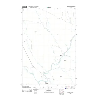
2011 Map of Wytopitlock
USGS Topo · Published 2011About this map
Wytopitlock and Bancroft center this topographical study of southern Aroostook County, where the Mattawamkeag River meets a network of vital northern brooks. The map documents a landscape defined by its timber and river history, with several roads like Sawmill Rd and Baskahegan Rd hinting at the region's logging heritage. Significant elevation changes are marked by Spofford Ridge to the north and the uniquely named Sweet Chopping Ridge in the south, overlooking the confluence of the river and Mill Priviledge Brook. Small settlements like Upper Drew provide fixed points for genealogists tracing families in the Reed Plantation area. The intricate waterways, including Wytopitlock Stream and Joe Coro Brook, illustrate the natural drainage patterns that have long dictated movement and settlement in this part of Maine.
Find a feature on this map
25 named features on this map. Tap any name to fly to it.
Don’t see what you’re looking for? This feature index may not catch every label — zoom into the map to look around manually.
Map Details
Editions of this 2011 Wytopitlock Map
This is the sole edition of this map. No revisions or reprints were ever made.
Other maps of this area

1940 · Danforth
USGS Topo · 1:62,500

1940 · Amity
USGS Topo · 1:62,500

1941 · Danforth
USGS Topo · 1:62,500

1941 · Amity
USGS Topo · 1:62,500

1941 · Mattawamkeag Lake
USGS Topo · 1:62,500

1941 · Wytopitlock
USGS Topo · 1:62,500

1943 · Danforth
USGS Topo · 1:62,500

1943 · Wytopitlock
USGS Topo · 1:62,500

1943 · Amity
USGS Topo · 1:62,500

1943 · Mattawamkeag Lake
USGS Topo · 1:62,500
Featured Places
- Reed Plantation, ME
- Haynesville, ME
- Bancroft Township, ME
- Drew Plantation, ME
- Upper Drew, Drew Plantation