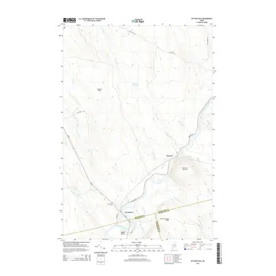
2014 Map of Wytopitlock
USGS Topo · Published 2014About this map
The Mattawamkeag River snakes through this remote Maine landscape, where the borders of Aroostook, Washington, and Penobscot counties converge. This 2014 survey documents the small settlements of Wytopitlock, Bancroft, and Upper Drew nestled along the river corridor and local transport routes like Bancroft Rd and Main St. The terrain is defined by prominent elevations such as Spofford Ridge and Sherwood Mountain, while the hydrology is marked by numerous watercourses including Palmer Deadwater, Finn Brook, and Wytopitlock Stream. Genealogists will find the Wytopitlock Cem located just north of the village. The presence of Mill Priviledge Brook suggests the historical industrial use of local water power in this timber-rich region, while the network of unpaved ways like Baskhegan Rd indicates the ongoing importance of forest access and land management in the northern woods.
Find a feature on this map
31 named features on this map. Tap any name to fly to it.
Don’t see what you’re looking for? This feature index may not catch every label — zoom into the map to look around manually.
Map Details
Editions of this 2014 Wytopitlock Map
This is the sole edition of this map. No revisions or reprints were ever made.
Other maps of this area

1940 · Danforth
USGS Topo · 1:62,500

1940 · Amity
USGS Topo · 1:62,500

1941 · Danforth
USGS Topo · 1:62,500

1941 · Amity
USGS Topo · 1:62,500

1941 · Mattawamkeag Lake
USGS Topo · 1:62,500

1941 · Wytopitlock
USGS Topo · 1:62,500

1943 · Danforth
USGS Topo · 1:62,500

1943 · Wytopitlock
USGS Topo · 1:62,500

1943 · Amity
USGS Topo · 1:62,500

1943 · Mattawamkeag Lake
USGS Topo · 1:62,500
Featured Places
- Reed Plantation, ME
- Haynesville, ME
- Bancroft Township, ME
- Drew Plantation, ME
- Upper Drew, Drew Plantation