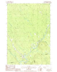
1988 Map of Wytopitlock
USGS Topo · Published 1988About this map
The settlement of Wytopitlock and the village of Bancroft define this late-1980s landscape at the convergence of several northern Maine plantation and county boundaries. The Mattawamkeag River snakes through the southern portion of the quadrangle, joined by the Wytopitlock Stream and numerous smaller tributaries like Angus Brook and Carlyle Brook. This area represents a classic Maine timber and water geography, where the river serves as the low-lying spine between prominent elevations such as Sherwood Mtn, Spofford Ridge, and Lee Ridge.
Find a feature on this map
30 named features on this map. Tap any name to fly to it.
Don’t see what you’re looking for? This feature index may not catch every label — zoom into the map to look around manually.
Map Details
Editions of this 1988 Wytopitlock Map
This is the sole edition of this map. No revisions or reprints were ever made.
Other maps of this area

1940 · Danforth
USGS Topo · 1:62,500

1940 · Amity
USGS Topo · 1:62,500

1941 · Danforth
USGS Topo · 1:62,500

1941 · Amity
USGS Topo · 1:62,500

1941 · Mattawamkeag Lake
USGS Topo · 1:62,500

1941 · Wytopitlock
USGS Topo · 1:62,500

1943 · Danforth
USGS Topo · 1:62,500

1943 · Wytopitlock
USGS Topo · 1:62,500

1943 · Amity
USGS Topo · 1:62,500

1943 · Mattawamkeag Lake
USGS Topo · 1:62,500
Featured Places
- Reed Plantation, ME
- Haynesville, ME
- Bancroft Township, ME
- Drew Plantation, ME
- Wytopitlock, Reed Plantation