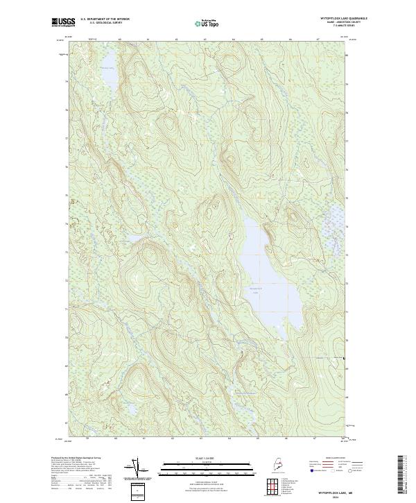
2024 Map of Wytopitlock Lake
USGS Topo · Published 2024About this map
Wytopitlock Lake and its surrounding wetlands dominate this pocket of Aroostook County, Maine. The landscape is defined by a dense network of watercourses, including Wytopitlock Stream and the Thompson Deadwater, which suggest a terrain historically shaped by logging and natural drainage patterns. To the north, Braley Lake and the smaller Duck Pond are connected by a web of brooks like Braley Brook and Hemore Brook. Human presence is concentrated along a few key corridors, notably Lake Rd and Dixie Rd. Near the eastern edge of the quadrangle, Pierce Cem stands as a significant landmark for genealogical research, situated just off the road. The map also captures the flow of the Macwahoc Stream in the southwest, winding past Lost Pond through an area of numerous unnamed marshes and tributary brooks.
Find a feature on this map
15 named features on this map. Tap any name to fly to it.
Don’t see what you’re looking for? This feature index may not catch every label — zoom into the map to look around manually.
Map Details
Editions of this 2024 Wytopitlock Lake Map
This is the sole edition of this map. No revisions or reprints were ever made.
Other maps of this area

1940 · Sherman
USGS Topo · 1:62,500

1940 · Mattawamkeag
USGS Topo · 1:62,500

1941 · Mattawamkeag Lake
USGS Topo · 1:62,500

1941 · Wytopitlock
USGS Topo · 1:62,500

1942 · Mattawamkeag
USGS Topo · 1:62,500

1942 · Sherman
USGS Topo · 1:62,500

1943 · Wytopitlock
USGS Topo · 1:62,500

1943 · Mattawamkeag Lake
USGS Topo · 1:62,500

1954 · Millinocket
USGS Topo · 1:250,000

1958 · Millinocket
USGS Topo · 1:250,000