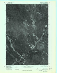
1975 Map of Wytopitlock NE
USGS Topo · Published 1980About this map
The Mattawamkeag River defines the landscape of this portion of Aroostook County, carving a winding path through the timberlands of northern Maine. This orthophoto map, created from aerial imagery taken in 1975, offers a rare photographic perspective of the area surrounding Bancroft and Wytopitlock. The visual detail captures the cleared land of small riverfront settlements and the surrounding forest canopy in striking clarity.
Find a feature on this map
5 named features on this map. Tap any name to fly to it.
Don’t see what you’re looking for? This feature index may not catch every label — zoom into the map to look around manually.
Map Details
Editions of this 1975 Wytopitlock NE Map
This is the sole edition of this map. No revisions or reprints were ever made.
Other maps of this area

1940 · Danforth
USGS Topo · 1:62,500

1940 · Amity
USGS Topo · 1:62,500

1941 · Danforth
USGS Topo · 1:62,500

1941 · Amity
USGS Topo · 1:62,500

1941 · Mattawamkeag Lake
USGS Topo · 1:62,500

1941 · Wytopitlock
USGS Topo · 1:62,500

1943 · Danforth
USGS Topo · 1:62,500

1943 · Wytopitlock
USGS Topo · 1:62,500

1943 · Amity
USGS Topo · 1:62,500

1943 · Mattawamkeag Lake
USGS Topo · 1:62,500
Featured Places
- Reed Plantation, ME
- Haynesville, ME
- Bancroft Township, ME
- Drew Plantation, ME
- Wytopitlock, Reed Plantation