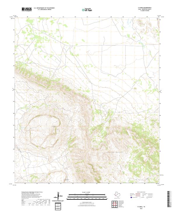
2022 Map of Y E Mesa
USGS Topo · Published 2022About this map
Y E Mesa and the Santiago Mountains dominate this high-desert landscape in Brewster County, where the topography transitions from steep ridgelines to the wide drainage basins characteristic of the Trans-Pecos. This 2022 survey captures the modern hydrological layout of the region, anchored by the presence of Y E Spring and the intermittent flows of Maravillas Cr and Hackberry Cr. The distribution of water sources like Spring Cr and the topographical prominence of Red Mtn illustrate the rugged environmental constraints that have shaped land use and ranching access in this part of West Texas for generations. The road network is sparse, centered on the Chalk Draw Rana Rd which provides access through the challenging terrain of Javelina Draw.
Find a feature on this map
9 named features on this map. Tap any name to fly to it.
Don’t see what you’re looking for? This feature index may not catch every label — zoom into the map to look around manually.
Map Details
Editions of this 2022 Y E Mesa Map
This is the sole edition of this map. No revisions or reprints were ever made.
Other maps of this area

1917 · Santiago Peak
USGS Topo · 1:62,500

1917 · Bone Spring
USGS Topo · 1:62,500

1917 · Hood Spring
USGS Topo · 1:62,500

1918 · Bone Spring
USGS Topo · 1:125,000

1918 · Hood Spring
USGS Topo · 1:62,500

1918 · Santiago Peak
USGS Topo · 1:62,500

1918 · Bone Spring
USGS Topo · 1:62,500

1918 · Nine Point Mesa
USGS Topo · 1:62,500

1920 · Bone Spring
USGS Topo · 1:62,500

1931 · Hood Spring
USGS Topo · 1:62,500