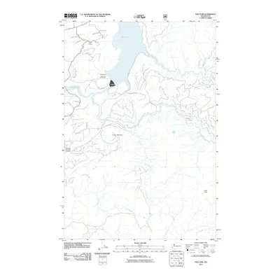
2011 Map of Yale Dam
USGS Topo · Published 2011About this map
Yale Lake and the hydroelectric infrastructure of the Lewis River dominate this Southwest Washington landscape. The map centers on the massive Yale Dam and the adjacent Saddle Dam, which contain the reservoir's waters for power generation. These 21st-century engineering works are set against a backdrop of deep drainage networks and prominent peaks, including the symmetrical profile of Tumtum Mountain and the high vantage point at Speelyai Hill Viewpoint.
Find a feature on this map
33 named features on this map. Tap any name to fly to it.
Don’t see what you’re looking for? This feature index may not catch every label — zoom into the map to look around manually.
Map Details
Editions of this 2011 Yale Dam Map
This is the sole edition of this map. No revisions or reprints were ever made.
Other maps of this area

1919 · Mount St Helens
USGS Topo · 1:125,000

1940 · Lookout Mtn
USGS Topo · 1:62,500

1941 · Yacolt
USGS Topo · 1:62,500

1948 · Vancouver
USGS Topo · 1:250,000

1950 · Vancouver
USGS Topo · 1:250,000

1950 · Vancouver
USGS Topo · 1:250,000

1953 · Hoquiam
USGS Topo · 1:250,000

1953 · Lookout Mtn
USGS Topo · 1:62,500

1953 · Cougar
USGS Topo · 1:62,500
1956 · Yacolt
USGS Topo · 1:62,500