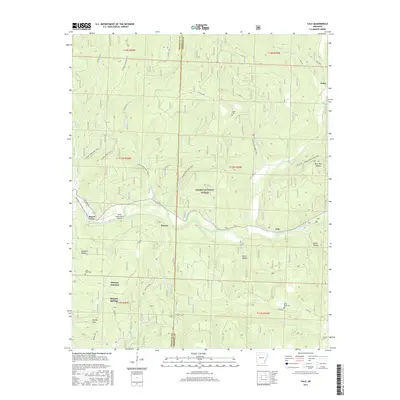
2017 Map of Yale
USGS Topo · Published 2017About this map
Ozark National Forest dominates the landscape of this Arkansas survey, where the Mulberry Wild and Scenic River carves a path through the southern half of the quadrangle. Small settlements like Yale, Peanut, and Beach Grove line the river valley and nearby hills, connected by roads such as State Hwy 215 and Cass Oark Rd. The presence of Byrd's Backcountry Airstrip near Beach Grove highlights the area's utility for remote access.
Find a feature on this map
43 named features on this map. Tap any name to fly to it.
Don’t see what you’re looking for? This feature index may not catch every label — zoom into the map to look around manually.
Map Details
Editions of this 2017 Yale Map
This is the sole edition of this map. No revisions or reprints were ever made.
Other maps of this area

1879 · Cravens
USGS Topo · 1:62,500

1887 · Watalula
USGS Topo · 1:62,500

1906 · Batson
USGS Topo · 1:62,500

1939 · Watalula
USGS Topo · 1:62,500

1943 · St. Paul
USGS Topo · 1:62,500

1946 · St. Paul
USGS Topo · 1:62,500

1956 · Russellville
USGS Topo · 1:250,000
1963 · Harmony
USGS Topo · 1:24,000
1963 · Hunt
USGS Topo · 1:24,000

1964 · Russellville
USGS Topo · 1:250,000