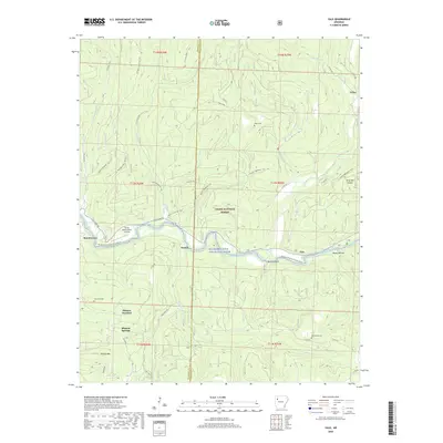
2020 Map of Yale
USGS Topo · Published 2020About this map
The Mulberry Wild and Scenic River carves a central path through this section of the Ozark National Forest on the border of Franklin and Johnson counties. Small settlements and crossroads like Yale, Peanut, and Beach Grove dot the river valley, connected by winding routes such as the Cass Oark Rd. The map reveals a landscape defined by deep drainages and ridges, including Wolf Pen Hollow, Butts Hollow, and Brushy Mtn.
Find a feature on this map
50 named features on this map. Tap any name to fly to it.
Don’t see what you’re looking for? This feature index may not catch every label — zoom into the map to look around manually.
Map Details
Editions of this 2020 Yale Map
This is the sole edition of this map. No revisions or reprints were ever made.
Other maps of this area

1879 · Cravens
USGS Topo · 1:62,500

1887 · Watalula
USGS Topo · 1:62,500

1906 · Batson
USGS Topo · 1:62,500

1939 · Watalula
USGS Topo · 1:62,500

1943 · St. Paul
USGS Topo · 1:62,500

1946 · St. Paul
USGS Topo · 1:62,500

1956 · Russellville
USGS Topo · 1:250,000
1963 · Harmony
USGS Topo · 1:24,000
1963 · Hunt
USGS Topo · 1:24,000

1964 · Russellville
USGS Topo · 1:250,000