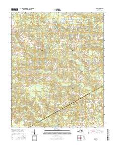
2016 Map of Yale
USGS Topo · Published 2016About this map
Hornet Swamp and the dense network of tributaries like Poplar Swamp define the low-lying landscape along the border of Sussex and Southampton Counties. This 2016 survey captures the rural character of southeastern Virginia, where historic crossroads settlements like Yale, Hilda, and Gray persist as quiet residential nodes connected by a web of local roads. The map's detail is particularly valuable for genealogical research, identifying local burial sites such as Calvary Cem and Antioch Cem that might otherwise be overlooked in larger-scale studies.
Find a feature on this map
47 named features on this map. Tap any name to fly to it.
Don’t see what you’re looking for? This feature index may not catch every label — zoom into the map to look around manually.
Map Details
Editions of this 2016 Yale Map
This is the sole edition of this map. No revisions or reprints were ever made.
Other maps of this area

1919 · Jarratt
USGS Topo · 1:62,500

1919 · Homeville
USGS Topo · 1:48,000

1919 · Boykins
USGS Topo · 1:48,000

1919 · Arringdale
USGS Topo · 1:48,000

1920 · Homeville
USGS Topo · 1:62,500

1920 · Boykins
USGS Topo · 1:62,500

1920 · Arringdale
USGS Topo · 1:62,500

1942 · Arringdale
USGS Topo · 1:62,500

1943 · Sebrell
USGS Topo · 1:31,680

1943 · Littleton
USGS Topo · 1:31,680