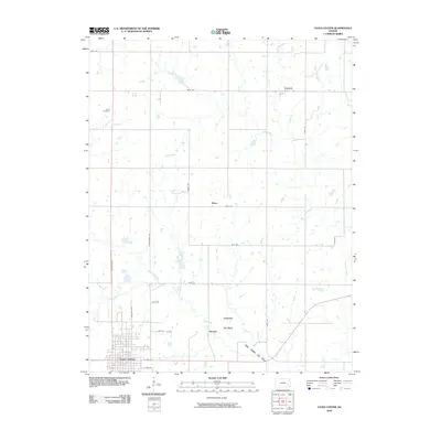
2009 Map of Yates Center
USGS Topo · Published 2009About this map
The town of Yates Center serves as the focal point of this Woodson County landscape, appearing as a developed grid at the southern edge of a predominantly agricultural and industrial region. To the north, the terrain is defined by a network of drainage systems including North Owl Creek, School Creek, and Cherry Creek, which wind through a landscape punctuated by several smaller named locales. The map reveals a legacy of energy extraction, most notably at the Durand Oil Field and the Owl Creek Oil Field, where the infrastructure of the oil industry overlaps with rural farming acreage. Genealogists will find the Dutro Cemetery north of town, while historians can trace the smaller settlements of Durand, Vernon, and Hasty, which are connected by an extensive system of secondary roads such as Nighthawk Rd and Osage Rd.
Find a feature on this map
27 named features on this map. Tap any name to fly to it.
Don’t see what you’re looking for? This feature index may not catch every label — zoom into the map to look around manually.
Map Details
Editions of this 2009 Yates Center Map
This is the sole edition of this map. No revisions or reprints were ever made.
Other maps of this area

1885 · Burlington
USGS Topo · 1:125,000

1886 · Fredonia
USGS Topo · 1:125,000

1894 · Fredonia
USGS Topo · 1:125,000

1894 · Burlington
USGS Topo · 1:125,000

1947 · Lawrence
USGS Topo · 1:250,000

1947 · Joplin
USGS Topo · 1:250,000

1949 · Joplin
USGS Topo · 1:250,000

1950 · Lawrence
USGS Topo · 1:250,000

1954 · Joplin
USGS Topo · 1:250,000

1956 · Lawrence
USGS Topo · 1:250,000