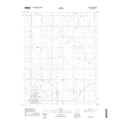
2018 Map of Yates Center
USGS Topo · Published 2018About this map
Yates Center serves as the primary hub for this portion of Woodson County, showcasing a dense street grid that includes E Madison St, W Bell St, and S Main St. The surrounding landscape is defined by the drainage basins of Owl Cr and its northern branch, N Owl Cr, along with smaller tributaries like Bloody Run and School Cr. This 2018 survey reveals the persistent rural footprint of the Kansas plains, where small settlements such as Vernon, Hasty, and Durand are connected by an extensive network of range and township roads. For local historians and genealogists, the placement of the Dutro Cem north of Yates Center provides a vital point of reference for tracing family roots in the area. The geography is marked by gentle undulations and the winding courses of Cherry Cr, illustrating the agricultural layout of the region in the early 21st century.
Find a feature on this map
58 named features on this map. Tap any name to fly to it.
Don’t see what you’re looking for? This feature index may not catch every label — zoom into the map to look around manually.
Map Details
Editions of this 2018 Yates Center Map
This is the sole edition of this map. No revisions or reprints were ever made.
Other maps of this area

1885 · Burlington
USGS Topo · 1:125,000

1886 · Fredonia
USGS Topo · 1:125,000

1894 · Fredonia
USGS Topo · 1:125,000

1894 · Burlington
USGS Topo · 1:125,000

1947 · Lawrence
USGS Topo · 1:250,000

1947 · Joplin
USGS Topo · 1:250,000

1949 · Joplin
USGS Topo · 1:250,000

1950 · Lawrence
USGS Topo · 1:250,000

1954 · Joplin
USGS Topo · 1:250,000

1956 · Lawrence
USGS Topo · 1:250,000