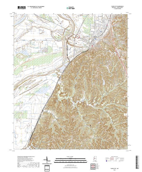
2024 Map of Yazoo City
USGS Topo · Published 2024About this map
Yazoo City serves as the focal point of this Mississippi Delta landscape, where the town's street grid meets the winding Yazoo River. The geography is defined by significant hydraulic engineering projects intended to manage the delta's waters, notably the Yazoo City Cut-Off and the Jonestown Cut-Off. These man-made channels highlight the historic struggle and adaptation to the river's seasonal flooding. To the west, the expansive Panther Swamp National Wildlife Refuge preserves a massive tract of bottomland hardwood forest, contrasting with the industrial and residential development near the Yazoo County Courthouse. Smaller rural communities like Crupp and Valley sit further south along the Canadian National rail line, while local landmarks like the Short Creek Church Cem provide specific points of interest for genealogists tracing family histories in the county.
Find a feature on this map
129 named features on this map. Tap any name to fly to it.
Don’t see what you’re looking for? This feature index may not catch every label — zoom into the map to look around manually.
Map Details
Editions of this 2024 Yazoo City Map
This is the sole edition of this map. No revisions or reprints were ever made.
Other maps of this area

1940 · Mechanicsburg
USGS Topo · 1:62,500

1955 · Jackson
USGS Topo · 1:250,000

1961 · Jackson
USGS Topo · 1:250,000

1961 · Bayland
USGS Topo · 1:62,500

1961 · Valley
USGS Topo · 1:62,500

1962 · Jackson
USGS Topo · 1:250,000

1962 · Flora
USGS Topo · 1:62,500

1963 · Mechanicsburg
USGS Topo · 1:62,500

1984 · Yazoo City
USGS Topo · 1:100,000
1988 · Eden
USGS Topo · 1:24,000