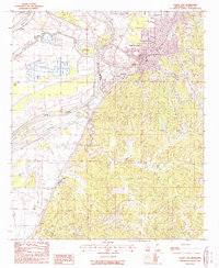
1988 Map of Yazoo City
USGS Topo · Published 1988About this map
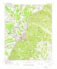
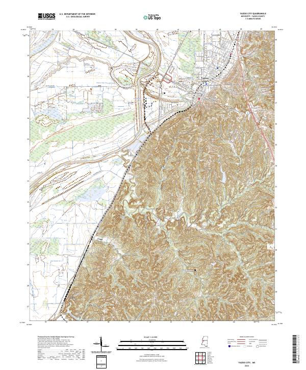
The Yazoo River defines the landscape of this 1980s Mississippi Delta quadrangle, illustrating the complex hydrology and engineered waterways of the region. A significant local landmark is the Yazoo City Cut-Off 1940, an engineering project that redirected the river's path nearly half a century before this survey. On the bluffs and floodplains, Yazoo City stands as the primary hub, supported by the Yazoo Co Port and the nearby Muni Airport. The map documents small riverside communities like Jonestown and Crupp, alongside specialized land uses such as a Fish Farm near the Yazoo City Cut-Off. To the west, the oxbow at Broad Lake and the meandering Wade Bayou indicate the ancient natural drainage patterns that persist alongside modern levee and port infrastructure.
Find a feature on this map
16 named features on this map. Tap any name to fly to it.
Don’t see what you’re looking for? This feature index may not catch every label — zoom into the map to look around manually.
Map Details
Editions of this 1988 Yazoo City Map
This is the sole edition of this map. No revisions or reprints were ever made.
Historical Maps of Yazoo City Through Time
8 maps found