
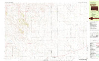
1981 Map of Yellow Bear Camp
USGS Topo · Published 1981About this map
Yellow Bear Camp serves as a focal point within the Pine Ridge Indian Reservation, where the landscape is defined by the deep dissection of Yellow Bear Canyon and a complex drainage network. The map records several vital community sites, including Mediator Cem in the northwest and Body of Christ Cem and Trinity Cem further south and east. These locations, alongside a persistent Foot Trail, reflect the established patterns of movement and heritage in this portion of South Dakota. Numerous watercourses, such as Medicine Root Creek and American Horse Creek, carve through the terrain, illustrating how the natural topography has dictated the placement of roads and settlements. The presence of the Shannon Co and Bennett Co boundary provides a administrative reference point for local history researchers and genealogists tracing family ties across these county lines.
Find a feature on this map
15 named features on this map. Tap any name to fly to it.
Don’t see what you’re looking for? This feature index may not catch every label — zoom into the map to look around manually.
Map Details
Editions of this 1981 Yellow Bear Camp Map
This is the sole edition of this map. No revisions or reprints were ever made.
Other maps of this area

1955 · Hot Springs
USGS Topo · 1:250,000

1955 · Martin
USGS Topo · 1:250,000

1958 · Martin
USGS Topo · 1:250,000

1967 · Wounded Knee
USGS Topo · 1:24,000

1981 · Allen
USGS Topo · 1:25,000

1981 · Kyle
USGS Topo · 1:25,000

1981 · Evergreen
USGS Topo · 1:25,000
1981 · Batesland
USGS Topo · 1:25,000

1981 · Evergreen NE
USGS Topo · 1:24,000

1981 · Hisle
USGS Topo · 1:25,000