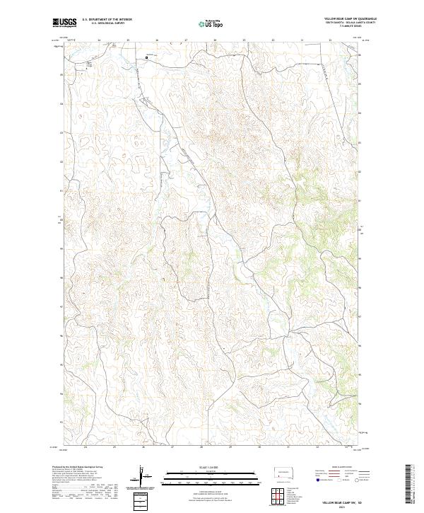
2021 Map of Yellow Bear Camp SW
USGS Topo · Published 2021About this map
Oglala Lakota College sits in the northwestern corner of this territory, where the terrain is defined by the winding drainages of American Horse Cr and its tributaries. The landscape is marked by a network of rural roads such as American Horse Creek Rd and Red Owl Springs Rd, which follow the natural contours of the high plains. Cultural and historical points of interest are sparse but significant, notably the Mediator Cem located near the northern boundary. The hydrography of the region is centered on several important waterways, including Threemile Cr and Medicine Root Cr, which carve through the plains. The map illustrates a contemporary view of the Pine Ridge Reservation area, showing the enduring spatial relationship between institutional centers and the wide-reaching network of named creeks and local thoroughfares.
Find a feature on this map
17 named features on this map. Tap any name to fly to it.
Don’t see what you’re looking for? This feature index may not catch every label — zoom into the map to look around manually.
Map Details
Editions of this 2021 Yellow Bear Camp SW Map
This is the sole edition of this map. No revisions or reprints were ever made.
Other maps of this area

1955 · Hot Springs
USGS Topo · 1:250,000

1967 · Wounded Knee
USGS Topo · 1:24,000

1981 · Yellow Bear Camp
USGS Topo · 1:25,000

1981 · Kyle
USGS Topo · 1:25,000

1981 · Evergreen
USGS Topo · 1:25,000
1981 · Batesland
USGS Topo · 1:25,000

1981 · Evergreen NE
USGS Topo · 1:24,000

1985 · Pine Ridge
USGS Topo · 1:100,000
2012 · Batesland NW
USGS Topo · 1:24,000
2012 · Kyle
USGS Topo · 1:24,000