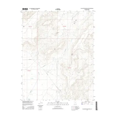
2017 Map of Yellow Rock Point West
USGS Topo · Published 2017About this map
White Mesa and the expansive formations of the Shiprock Agency define this high-desert landscape in southeastern Utah. The area is characterized by a series of prominent geological landmarks, including the central Three Gray Hills and the massive profile of Flat Mesa. These features are cut by seasonal drainage systems like Rough Canyon Cr and the extensive Tsitah Wash, which flows through the Tsitah Valley in the northeast. Human presence is marked by a network of rural routes such as Teec Nos Pos Rd and S San Juan River Rd, which connect the isolated terrain to regional hubs. Water management in this arid environment is evidenced by the Red Shirt Reservoir, a critical point of interest for understanding local land use and resource management in the San Juan County region.
Find a feature on this map
22 named features on this map. Tap any name to fly to it.
Don’t see what you’re looking for? This feature index may not catch every label — zoom into the map to look around manually.
Map Details
Editions of this 2017 Yellow Rock Point West Map
This is the sole edition of this map. No revisions or reprints were ever made.
Other maps of this area

1886 · Abajo
USGS Topo · 1:250,000

1892 · Abajo
USGS Topo · 1:250,000

1892 · Canyon De Chelly
USGS Topo · 1:250,000

1893 · Abajo
USGS Topo · 1:250,000

1953 · Pastora Peak NW
USGS Topo · 1:24,000

1953 · Dinne Mesa NE
USGS Topo · 1:24,000

1953 · Pastora Peak NE
USGS Topo · 1:24,000

1953 · Pastora Peak
USGS Topo · 1:62,500

1953 · Toh-Atin Mesa
USGS Topo · 1:62,500

1954 · Shiprock
USGS Topo · 1:250,000