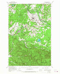
1959 Map of Yelm
USGS Topo · Published 1968About this map
The Nisqually River and Deschutes River frame this mid-century portrait of south Puget Sound prairie and timberlands. The settlement at Yelm serves as a central hub, where the Great Northern and Northern Pacific rails intersect, supporting an economy built on agriculture and timber. To the west, the Rainier Training Area marks the military presence near Rainier, while the Nisqually Indian Res Bdy defines the northern reaches near Roy.
Find a feature on this map
104 named features on this map. Tap any name to fly to it.
Don’t see what you’re looking for? This feature index may not catch every label — zoom into the map to look around manually.
Map Details
Editions of this 1959 Yelm Map
This is the sole edition of this map. No revisions or reprints were ever made.
Other maps of this area

1897 · Tacoma
USGS Topo · 1:125,000

1900 · Tacoma
USGS Topo · 1:125,000

1916 · Chehalis
USGS Topo · 1:125,000

1937 · Olympia
USGS Topo · 1:62,500

1937 · Eatonville
USGS Topo · 1:125,000

1940 · Tenino
USGS Topo · 1:62,500

1940 · Anderson Island
USGS Topo · 1:62,500

1941 · Tanwax Lake
USGS Topo · 1:62,500

1941 · Tacoma South
USGS Topo · 1:62,500

1943 · Willapa
USGS Topo · 1:62,500