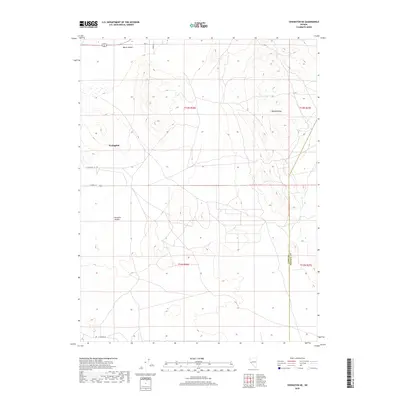
2018 Map of Yerington NE
USGS Topo · Published 2018About this map
The eastern edges of Yerington meet the high desert floor where the fertile Mason Valley gives way to the rising slopes of the Wassuk Range. This 2018 survey documents a landscape of transition, where residential development and agricultural plots around E Pursel Ln and E Walker Rd press against the open topography of Pumpkin Hollow. The grid of sections reveals the organized expansion of Lyon County as it extends toward the Lyon County and Mineral County line. Local routes like Fox Ln, Andes Ln, and E Cremetti Ln anchor the scattered homesteads and ranches that characterize this pocket of Nevada. Geologists and local historians will find interest in the precise contouring of the alluvial fans and the clear demarcation of township boundaries including t13n r26e and t12n r26e.
Find a feature on this map
14 named features on this map. Tap any name to fly to it.
Don’t see what you’re looking for? This feature index may not catch every label — zoom into the map to look around manually.
Map Details
Editions of this 2018 Yerington NE Map
This is the sole edition of this map. No revisions or reprints were ever made.
Other maps of this area

1891 · Wabuska
USGS Topo · 1:125,000

1891 · Wellington
USGS Topo · 1:125,000

1893 · Wellington
USGS Topo · 1:125,000

1894 · Wabuska
USGS Topo · 1:125,000

1908 · Carson Sink
USGS Topo · 1:250,000

1909 · Hawthorne
USGS Topo · 1:250,000

1910 · Carson Sink
USGS Topo · 1:250,000

1911 · Hawthorne
USGS Topo · 1:250,000

1915 · Hawthorne
USGS Topo · 1:250,000

1948 · Walker Lake
USGS Topo · 1:250,000