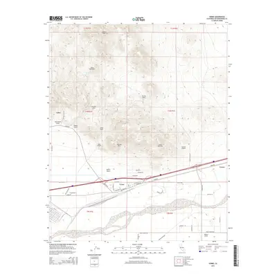
2015 Map of Yermo
USGS Topo · Published 2015About this map
The Calico Mountains and their high point at Calico Peak dominate this High Desert landscape, where the historic mining camp of Calico sits at the edge of the Mojave Desert. The map details the intricate topography of the range, naming geological landmarks such as Kramer Arch, Chimney Rock, and the Green Ash Hills, while tracing the paths of Wall Street Canyon and Odessa Canyon.
Find a feature on this map
50 named features on this map. Tap any name to fly to it.
Don’t see what you’re looking for? This feature index may not catch every label — zoom into the map to look around manually.
Map Details
Editions of this 2015 Yermo Map
This is the sole edition of this map. No revisions or reprints were ever made.
Other maps of this area

1933 · Avawatz Mountains
USGS Topo · 1:250,000

1947 · Trona
USGS Topo · 1:250,000

1948 · Trona
USGS Topo · 1:250,000

1948 · Alvord Mountain
USGS Topo · 1:62,500

1948 · Lane Mountain
USGS Topo · 1:62,500

1951 · Alvord Mountain
USGS Topo · 1:62,500

1951 · Lane Mountain
USGS Topo · 1:62,500

1953 · San Bernardino
USGS Topo · 1:250,000

1953 · Yermo
USGS Topo · 1:24,000

1953 · Trona
USGS Topo · 1:250,000