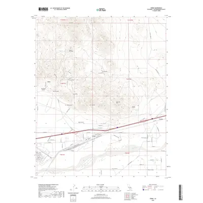
2018 Map of Yermo
USGS Topo · Published 2018About this map
Calico and the high desert terrain of the Calico Mountains dominate the northern half of this 2018 survey, reflecting a landscape defined by its mining heritage and stark geological features. Deep canyons such as Wall Street Canyon and Odessa Canyon cut through the volcanic hills, while landmarks like Kramer Arch and Chimney Rock highlight the area's distinctive topography. To the south, the settlement of Yermo sits at a critical junction of transport and water, positioned near the Mojave River and the Union Pacific RR. This modern map traces the development of the corridor along Calico Blvd and Yermo Rd, contrasting the high, arid peaks of Calico Peak with the agricultural and logistical layout of the Mojave Valley.
Find a feature on this map
73 named features on this map. Tap any name to fly to it.
Don’t see what you’re looking for? This feature index may not catch every label — zoom into the map to look around manually.
Map Details
Editions of this 2018 Yermo Map
This is the sole edition of this map. No revisions or reprints were ever made.
Other maps of this area

1933 · Avawatz Mountains
USGS Topo · 1:250,000

1947 · Trona
USGS Topo · 1:250,000

1948 · Trona
USGS Topo · 1:250,000

1948 · Alvord Mountain
USGS Topo · 1:62,500

1948 · Lane Mountain
USGS Topo · 1:62,500

1951 · Alvord Mountain
USGS Topo · 1:62,500

1951 · Lane Mountain
USGS Topo · 1:62,500

1953 · San Bernardino
USGS Topo · 1:250,000

1953 · Yermo
USGS Topo · 1:24,000

1953 · Trona
USGS Topo · 1:250,000