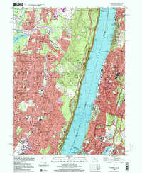
2023 Map of Yonkers
USGS Topo · Published 2023About this map
The Palisades dominate the center of this landscape, forming a dramatic natural wall along the western bank of the Hudson River. This modern survey reveals a densely developed corridor stretching from the heights of Yonkers and the northern Bronx in New York across to the established suburban boroughs of Bergen County, New Jersey. The infrastructure of the region is defined by historic engineering projects like the New Croton Aqueduct and the expansive Oradell Reservoir, which highlight the area's long-standing role in supporting the metropolitan water supply.
Find a feature on this map
80 named features on this map. Tap any name to fly to it.
Don’t see what you’re looking for? This feature index may not catch every label — zoom into the map to look around manually.
Map Details
Editions of this 2023 Yonkers Map
This is the sole edition of this map. No revisions or reprints were ever made.
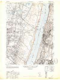
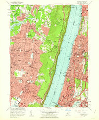
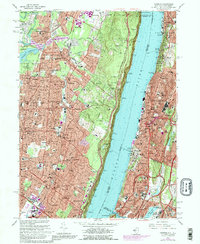
Historical Maps of Yonkers Through Time
5 maps found