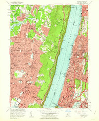
1956 Map of Yonkers
USGS Topo · Published 1963About this map
The Hudson River serves as the central divide in this mid-1950s survey, separating the steep Palisades of New Jersey from the burgeoning urban landscape of New York. On the eastern shore, Yonkers and the northern Bronx show a dense network of residential streets, parochial schools like Sacred Heart Sch, and expansive public works such as the Jerome Park Reservoir. Further south, the transition into Manhattan begins at Spuyten Duyvil where the New York Central Railroad hugs the riverbank.
Find a feature on this map
106 named features on this map. Tap any name to fly to it.
Don’t see what you’re looking for? This feature index may not catch every label — zoom into the map to look around manually.
Map Details
Editions of this 1956 Yonkers Map
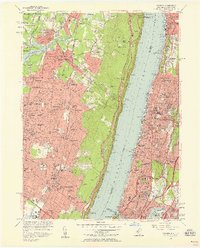
2 editions found
Other maps of this area

1888 · Paterson
USGS Topo · 1:62,500

1891 · Ramapo
USGS Topo · 1:62,500

1891 · Harlem
USGS Topo · 1:62,500

1892 · Paterson
USGS Topo · 1:62,500

1892 · Tarrytown
USGS Topo · 1:62,500

1893 · Tarrytown
USGS Topo · 1:62,500

1893 · Ramapo
USGS Topo · 1:62,500

1897 · Harlem
USGS Topo · 1:62,500

1898 · Harlem
USGS Topo · 1:62,500

1898 · Paterson
USGS Topo · 1:62,500