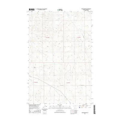
2017 Map of York Reservoir
USGS Topo · Published 2017About this map
York Reservoir sits in the northern reaches of this Garfield County landscape, serving as a primary water feature in a region defined by its complex drainage network. The terrain is marked by deep incisions such as Lynch Coulee, with numerous seasonal and perennial streams like Red Horse Cr and Lone Tree Cr flowing through the townships. The rural infrastructure of the early 21st century is represented by primitive transport routes, including the appropriately named Two Furrows Rd and Jacobson Rd. These corridors provide access through the sprawling sections of t17n r39e and t16n r40e, where the convergence of Longs Fork and Langs Fork highlights the intricate hydrology of the eastern Montana plains.
Find a feature on this map
14 named features on this map. Tap any name to fly to it.
Don’t see what you’re looking for? This feature index may not catch every label — zoom into the map to look around manually.
Map Details
Editions of this 2017 York Reservoir Map
This is the sole edition of this map. No revisions or reprints were ever made.
Other maps of this area

1954 · Jordan
USGS Topo · 1:250,000

1956 · Jordan
USGS Topo · 1:250,000

1958 · Jordan
USGS Topo · 1:250,000

1964 · Jordan
USGS Topo · 1:250,000

1964 · Jordan SE
USGS Topo · 1:24,000

1964 · Ada Creek
USGS Topo · 1:24,000

1964 · Black John Coulee
USGS Topo · 1:24,000

1965 · Cohagen
USGS Topo · 1:24,000

1965 · Kirby Ranch
USGS Topo · 1:24,000

1965 · Dice Dam
USGS Topo · 1:24,000