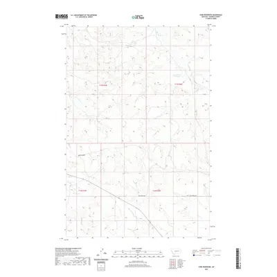
2020 Map of York Reservoir
USGS Topo · Published 2020About this map
York Reservoir sits at the northern edge of this Garfield County landscape, a vital water source in an area defined by its drainage network. The terrain is characterized by deep erosional features like Lynch Coulee and the winding paths of Langs Fork and Lone Tree Creek. This 2020 survey reveals a sparse infrastructure, where the primary overland route is the aptly named Two Furrows Rd, cutting diagonally across the southeastern townships. The map details the complex hydrography of the region, tracing the seasonal flows of Red Horse Creek, Second Creek, and Hay Creek. These watercourses dictate the rhythm of this remote Montana interior, where the Public Land Survey System grid sections out the land into the expansive blocks of T17N R39E and surrounding townships.
Find a feature on this map
12 named features on this map. Tap any name to fly to it.
Don’t see what you’re looking for? This feature index may not catch every label — zoom into the map to look around manually.
Map Details
Editions of this 2020 York Reservoir Map
This is the sole edition of this map. No revisions or reprints were ever made.
Other maps of this area

1954 · Jordan
USGS Topo · 1:250,000

1956 · Jordan
USGS Topo · 1:250,000

1958 · Jordan
USGS Topo · 1:250,000

1964 · Jordan
USGS Topo · 1:250,000

1964 · Jordan SE
USGS Topo · 1:24,000

1964 · Ada Creek
USGS Topo · 1:24,000

1964 · Black John Coulee
USGS Topo · 1:24,000

1965 · Cohagen
USGS Topo · 1:24,000

1965 · Kirby Ranch
USGS Topo · 1:24,000

1965 · Dice Dam
USGS Topo · 1:24,000