
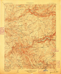
1903 Map of Yosemite
USGS Topo · Published 1903About this map
The Merced River and Tuolumne River watersheds define this turn-of-the-century topographic record, captured just after the turn of the century. The map illustrates a transitional landscape where early pioneer ranching and mining intersect with the burgeoning conservation movement. Significant ranching sites like Harden Ranch and Hodgdon Ranch are visible alongside early travel infrastructure such as the Stage Station near the park boundary. The lower elevations show established small settlements like Hite Cove, Kinsley, and Jerseydale, while the high country is marked by the early protected status of Yosemite National Park and the Sierra Forest Reserve.
Find a feature on this map
157 named features on this map. Tap any name to fly to it.
Don’t see what you’re looking for? This feature index may not catch every label — zoom into the map to look around manually.
Map Details
Editions of this 1903 Yosemite Map
2 editions found
Other maps of this area

1891 · Big Trees
USGS Topo · 1:125,000

1893 · Sonora
USGS Topo · 1:125,000

1894 · Big Trees
USGS Topo · 1:125,000

1896 · Dardanelles
USGS Topo · 1:125,000

1896 · Sonora
USGS Topo · 1:125,000

1897 · Sonora
USGS Topo · 1:125,000

1897 · Big Trees
USGS Topo · 1:125,000

1897 · Yosemite
USGS Topo · 1:125,000

1898 · Dardanelles
USGS Topo · 1:125,000

1898 · Sonora
USGS Topo · 1:125,000