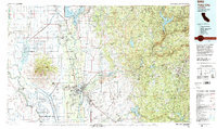
1993 Map of Yuba City
USGS Topo · Published 1994About this map
Sutter Buttes rise abruptly from the flat agricultural plains of the Sacramento Valley, creating a singular landmark surrounded by the Colusa Basin and Jimeno Basin. This landscape is defined by its complex water management systems, where the Sacramento River and Feather River are joined by the Sutter Bypass and an intricate network of canals like the Cherokee Canal. The transition from the valley floor into the Sierra Nevada foothills is marked by the sprawling Beale Air Force Base and the historic mining towns of Grass Valley and Nevada City.
Find a feature on this map
152 named features on this map. Tap any name to fly to it.
Don’t see what you’re looking for? This feature index may not catch every label — zoom into the map to look around manually.
Map Details
Editions of this 1993 Yuba City Map
This is the sole edition of this map. No revisions or reprints were ever made.
Other maps of this area

1888 · Marysville
USGS Topo · 1:125,000

1888 · Smartsville
USGS Topo · 1:125,000

1888 · Bidwell Bar
USGS Topo · 1:125,000

1891 · Bidwell Bar
USGS Topo · 1:125,000

1891 · Chico
USGS Topo · 1:125,000

1891 · Downieville
USGS Topo · 1:125,000

1891 · Sacramento
USGS Topo · 1:125,000

1891 · Colfax
USGS Topo · 1:125,000

1891 · Marysville
USGS Topo · 1:125,000

1891 · Smartsville
USGS Topo · 1:125,000