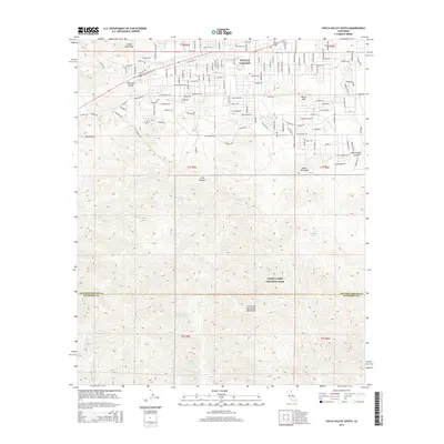
2015 Map of Yucca Valley South
USGS Topo · Published 2015About this map
Yucca Valley serves as the northern gateway to the desert wilderness in this 2015 survey, where the residential grids of the high desert meet the northern boundary of Joshua Tree National Park. The map documents a complex network of trails and roads that transition from suburban streets into the rising elevations of the Little San Bernardino Mountains. These routes, such as Silver Mine Trl and Free Gold Dr, hint at the area's historical prospecting roots. Deep within the park and the surrounding canyons, critical water sources are identified, including Chickawalla Bill Spring and Black Rock Spring. The topography is defined by prominent landmarks like North Park Peak and Burnt Mtn, illustrating the transition from the developed Morongo Valley to the protected southern desert landscape.
Find a feature on this map
61 named features on this map. Tap any name to fly to it.
Don’t see what you’re looking for? This feature index may not catch every label — zoom into the map to look around manually.
Map Details
Editions of this 2015 Yucca Valley South Map
This is the sole edition of this map. No revisions or reprints were ever made.
Other maps of this area

1901 · Southern California Sheet No. 1
USGS Topo · 1:250,000

1901 · San Jacinto
USGS Topo · 1:125,000

1902 · San Gorgonio
USGS Topo · 1:125,000

1904 · Southern California Sheet No. 1
USGS Topo · 1:250,000

1940 · Palm Springs
USGS Topo · 1:62,500

1941 · Edom
USGS Topo · 1:62,500

1944 · Palm Springs
USGS Topo · 1:62,500

1944 · Edom
USGS Topo · 1:62,500

1947 · Santa Ana
USGS Topo · 1:250,000

1949 · Santa Ana
USGS Topo · 1:250,000