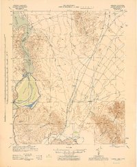
1945 Map of Yuma
USGS Topo · Published 1945About this map
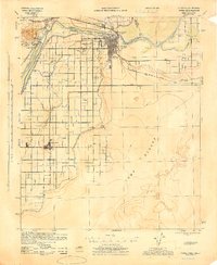
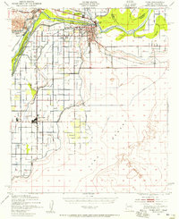
Yuma sits at the vital junction of the Colorado River and Gila River, serving as a critical desert gateway where Arizona, California, and Mexico converge. This mid-century survey illustrates an intricate irrigation network managed by the Imperial Irrigation District, featuring the Main Canal, East Yuma Main Canal, and West Main Canal which reclaimed the arid floor of the Yuma Desert. The landscape is defined by its transit history, shown through the crossing of the Southern Pacific and Inter-California Railroad lines. Local life is anchored by institutions like the Indian School Watertank, Yuma General Hospital, and rural campuses including Crane Sch and Rood Sch. To the south, Somerton and the international border post at Algodones highlight the region's agricultural and cross-border connectivity.
Find a feature on this map
29 named features on this map. Tap any name to fly to it.
Don’t see what you’re looking for? This feature index may not catch every label — zoom into the map to look around manually.
Map Details
Editions of this 1945 Yuma Map
This is the sole edition of this map. No revisions or reprints were ever made.
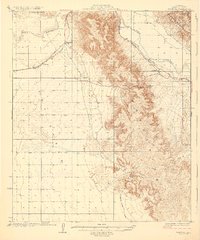
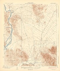
Other maps of this area

1903 · Yuma
USGS Topo · 1:125,000

1905 · Yuma
USGS Topo · 1:125,000

1926 · Fortuna
USGS Topo · 1:62,500
1929 · Fortuna
USGS Topo · 1:62,500
1929 · Laguna
USGS Topo · 1:62,500
1940 · Yuma
USGS Topo · 1:62,500

1942 · Yuma
USGS Topo · 1:250,000
1943 · Laguna
USGS Topo · 1:62,500

1945 · Picacho Peak
USGS Topo · 1:62,500
1951 · Picacho Peak
USGS Topo · 1:62,500