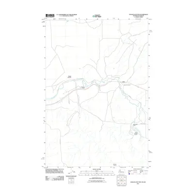
2011 Map of Zangar Junction
USGS Topo · Published 2011About this map
The Walla Walla River winds through this landscape near the border of Washington and Oregon, defining the agricultural character of the Walla Walla Valley. In this rural corridor, small rail-adjacent settlements like Zangar Junction and Reese stand along the riverbank, serving as key points for the transport of regional harvests. The terrain is marked by a series of deep drainages including Vansycle Canyon, Ninemile Canyon, and Warm Springs Canyon, which cut through the high ground surrounding the river basin. Local transit is facilitated by a network of gravel and paved roads, such as Game Depot Rd and Hatch Grade Rd, that navigate the varying elevations and connect the valley floors to the upland plateaus. This map provides a clear view of the irrigation patterns and topographic transitions critical to the area's farming heritage.
Find a feature on this map
12 named features on this map. Tap any name to fly to it.
Don’t see what you’re looking for? This feature index may not catch every label — zoom into the map to look around manually.
Map Details
Editions of this 2011 Zangar Junction Map
This is the sole edition of this map. No revisions or reprints were ever made.
Other maps of this area

1915 · Wallulah
USGS Topo · 1:96,000

1918 · Wallula
USGS Topo · 1:125,000

1935 · Pendleton
USGS Topo · 1:125,000

1953 · Pendleton
USGS Topo · 1:250,000

1953 · Walla Walla
USGS Topo · 1:250,000

1956 · Pendleton
USGS Topo · 1:250,000

1958 · Walla Walla
USGS Topo · 1:250,000

1964 · Wallula
USGS Topo · 1:24,000

1964 · Zangar Junction
USGS Topo · 1:24,000

1964 · Slater
USGS Topo · 1:24,000