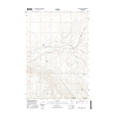
2017 Map of Zangar Junction
USGS Topo · Published 2017About this map
The Walla Walla River carves a significant course through this borderland, where the Walla Walla Valley meets the rising terrain of Vansycle Bluff and Rita Bluff. Centered on the railway and road crossing at Zangar Junction, the landscape is defined by its deep drainage systems including Vansycle Canyon and Ninemile Canyon. The map records a sparsely settled agricultural and transit corridor near the small settlement of Reese, situated along Nine Mile Canyon Rd. Significant for local historians and genealogists, the survey preserves the locations of numerous family-named roads such as Hatch Grade Rd, Byerley Rd, and Johnson Rd. The inclusion of the Walla Walla Horse Trail indicates the persistent use of traditional routes alongside modern infrastructure, spanning the boundary between Walla Walla County and Umatilla County at the Washington-Oregon state line.
Find a feature on this map
35 named features on this map. Tap any name to fly to it.
Don’t see what you’re looking for? This feature index may not catch every label — zoom into the map to look around manually.
Map Details
Editions of this 2017 Zangar Junction Map
This is the sole edition of this map. No revisions or reprints were ever made.
Other maps of this area

1915 · Wallulah
USGS Topo · 1:96,000

1918 · Wallula
USGS Topo · 1:125,000

1935 · Pendleton
USGS Topo · 1:125,000

1953 · Pendleton
USGS Topo · 1:250,000

1953 · Walla Walla
USGS Topo · 1:250,000

1956 · Pendleton
USGS Topo · 1:250,000

1958 · Walla Walla
USGS Topo · 1:250,000

1964 · Wallula
USGS Topo · 1:24,000

1964 · Zangar Junction
USGS Topo · 1:24,000

1964 · Slater
USGS Topo · 1:24,000