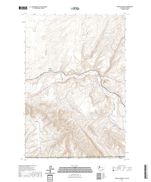
2023 Map of Zangar Junction
USGS Topo · Published 2023About this map
Mcnary National Wildlife Refuge borders the eastern bank of the Walla Walla River in this modern topographic study of the Walla Walla Valley. The terrain is defined by dramatic elevation changes where the river basin meets the steep uplands of Vansycle Bluff and Vansycle Canyon. This landscape is marked by several significant drainage features, including Warm Springs Canyon and Nine-mile Canyon, which carve through the high ground south of Zangar Junction.
Find a feature on this map
41 named features on this map. Tap any name to fly to it.
Don’t see what you’re looking for? This feature index may not catch every label — zoom into the map to look around manually.
Map Details
Editions of this 2023 Zangar Junction Map
This is the sole edition of this map. No revisions or reprints were ever made.
Other maps of this area

1915 · Wallulah
USGS Topo · 1:96,000

1918 · Wallula
USGS Topo · 1:125,000

1935 · Pendleton
USGS Topo · 1:125,000

1953 · Pendleton
USGS Topo · 1:250,000

1953 · Walla Walla
USGS Topo · 1:250,000

1956 · Pendleton
USGS Topo · 1:250,000

1958 · Walla Walla
USGS Topo · 1:250,000

1964 · Wallula
USGS Topo · 1:24,000

1964 · Zangar Junction
USGS Topo · 1:24,000

1964 · Slater
USGS Topo · 1:24,000