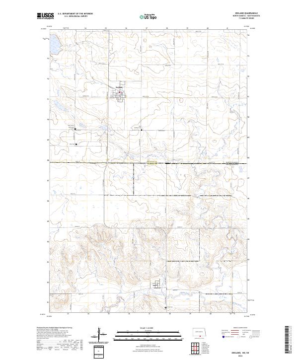
2024 Map of Zeeland
USGS Topo · Published 2024About this map
Zeeland, North Dakota, serves as the primary hub in this borderland survey, situated just north of the McIntosh and Campbell county line. The map captures the quiet transition between North and South Dakota, where the town site of Artas sits along Railway Ave near the southern edge of the quadrangle. This area is characterized by a high concentration of small rural cemeteries that serve as vital markers for family historians, including the Saint Johns Reformed Cem, Zion Cem, and Saint Andrews Cem scattered across the township lines. The landscape is primarily defined by its section-line road network and the meandering path of Spring Creek in the south, reflecting a late-20th-century prairie agricultural layout that has remained remarkably consistent in its footprint over decades.
Find a feature on this map
42 named features on this map. Tap any name to fly to it.
Don’t see what you’re looking for? This feature index may not catch every label — zoom into the map to look around manually.
Map Details
Editions of this 2024 Zeeland Map
This is the sole edition of this map. No revisions or reprints were ever made.
Other maps of this area

1953 · Jamestown
USGS Topo · 1:250,000

1954 · Aberdeen
USGS Topo · 1:250,000

1956 · Aberdeen
USGS Topo · 1:250,000

1956 · Jamestown
USGS Topo · 1:250,000

1978 · Greenway
USGS Topo · 1:24,000

1978 · Zeeland
USGS Topo · 1:24,000
1978 · Zeeland NW
USGS Topo · 1:24,000

1978 · Eureka West
USGS Topo · 1:24,000

1978 · Mutske Lake
USGS Topo · 1:24,000
1978 · Zeeland SW
USGS Topo · 1:24,000