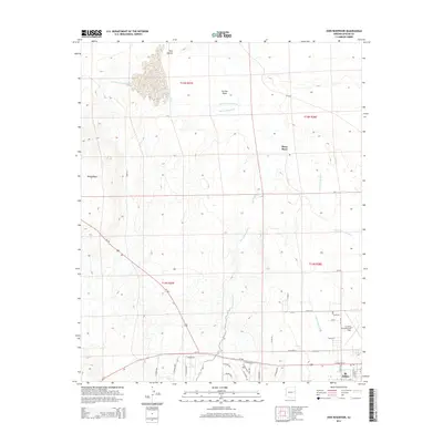
2014 Map of Zion Reservoir
USGS Topo · Published 2014About this map
The desert landscape around St. Johns is defined by the braided courses of the Little Colorado River and its major tributaries, including Carrizo Wash and Big Hollow Wash. This 2014 topographic survey reveals a region where water management is critical for settlement, illustrated by the presence of Zion Reservoir and the Lower Lyman Ditch. The town of St. Johns occupies the southeastern portion of the map, featuring a structured grid of streets such as Cleveland St and Plaza Dr. On the outskirts, the St Johns Industrial Air Park serves as a modern local hub, while isolated homesteads like Heap Place are scattered across the high plains. Geographic landmarks like Twin Buttes and the elevated Black Ridge provide distinct navigational points above the river valley. The map also traces the intersection of major transit routes Us-180 and Az-61, which link this remote high-country community to the broader Arizona interior.
Find a feature on this map
38 named features on this map. Tap any name to fly to it.
Don’t see what you’re looking for? This feature index may not catch every label — zoom into the map to look around manually.
Map Details
Editions of this 2014 Zion Reservoir Map
This is the sole edition of this map. No revisions or reprints were ever made.
Other maps of this area

1886 · St Johns
USGS Topo · 1:250,000

1892 · St Johns
USGS Topo · 1:250,000

1954 · Saint Johns
USGS Topo · 1:250,000

1955 · Adamana 4 NE
USGS Topo · 1:24,000

1955 · Wolford Springs 3 NW
USGS Topo · 1:24,000

1955 · Adamana 4 SE
USGS Topo · 1:24,000

1955 · Wolford Springs 3 SW
USGS Topo · 1:24,000

1955 · Hunt
USGS Topo · 1:62,500

1957 · Saint Johns
USGS Topo · 1:250,000

1958 · Saint Johns
USGS Topo · 1:250,000