
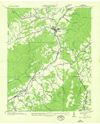
1935 Map of Zionville
USGS Topo · Published 1935About this map
Trade, Tennessee and Zionville, North Carolina anchor this 1935 advance sheet, where the state line follows the winding ridgelines of the Appalachian high country. The Tennessee Valley Authority and U.S. Geological Survey documented this rugged borderland just as U S State Highway No 421 and State Highway No 67 began to formalize old mountain passages. The landscape is defined by massive geographic markers like Snake Mountain and Cove Creek Mountain, with settlements huddled in the gaps and along the headwaters of Roan Creek.
Find a feature on this map
30 named features on this map. Tap any name to fly to it.
Don’t see what you’re looking for? This feature index may not catch every label — zoom into the map to look around manually.
Map Details
Editions of this 1935 Zionville Map
This is the sole edition of this map. No revisions or reprints were ever made.
Other maps of this area

1893 · Cranberry
USGS Topo · 1:125,000

1895 · Cranberry
USGS Topo · 1:125,000

1899 · Cranberry
USGS Topo · 1:125,000

1902 · Cranberry
USGS Topo · 1:125,000

1934 · Valle Crucis
USGS Topo · 1:24,000

1934 · Boone
USGS Topo · 1:24,000

1935 · Baldwin Gap
USGS Topo · 1:24,000

1935 · Doe Mountain
USGS Topo · 1:48,000

1935 · Sherwood
USGS Topo · 1:24,000
1935 · Mountain City
USGS Topo · 1:24,000