1900s (20th Century) Maps of Ponce
Explore 41 historic maps of Ponce from the 1900s (20th Century). These maps offer a rare glimpse into what life looked like during the 1900s — showing old roads, neighborhoods, homes, and landmarks that have changed or disappeared over time.
Whether you're researching your family's past, planning a metal detecting trip, or studying how Ponce's landscape evolved across the 1900s, these high-resolution maps are a powerful tool for exploring the history of this region.
- Focus on a specific era: All maps on this page are from the 1900s, giving you a focused view of this time period.
- See what’s changed: Compare century-old streets, trails, and buildings to today's modern landscape using overlays and satellite layers.
- Research with precision: Use these maps for genealogy, historical research, land use analysis, or educational projects.
- View, download, or print: Maps are fully viewable online in high resolution, and can be downloaded or printed for your own records.
Start exploring Ponce's history through authentic maps from the 1900s. This is your window into the past.
Ponce maps
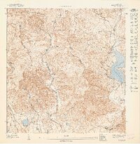
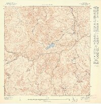
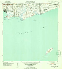
(41)- 1945 Map of Playa De Ponce
 1945 Playa De Ponce1945 Print · USGSThe coastal sugar economy of southern Puerto Rico is on full display here during the mid-1940s. Genealogists and industrial historians can trace the operations of Central Constancia and the rail lines of the American Railroad of Puerto Rico.3 unique versions available
 - 1945 Map of Ponce
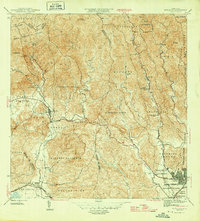
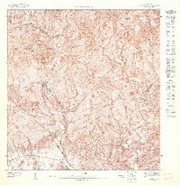
 1945 Ponce1945 Print · USGSThe southern coast of Puerto Rico in the 1940s showcases a landscape shaped by sugar production and ancestral haciendas. Genealogists and historians can trace family roots through numerous named estates like Hacienda Anón and industrial centers like Central Mercedita.3 unique versions available
 - 1946 Map of Punta Cuchara
 1946 Punta Cuchara1946 Print · USGSThe southern coast of Puerto Rico appears here during the mid-1940s, showing the vital maritime and rail corridors near Ponce. Researchers can locate the American Railroad line and trace agricultural estates like Hacienda Matilde or the old Faro on Cayo Cardona.3 unique versions available
 - 1946 Map of Jayuya
 1946 Jayuya1946 Print · USGSThe high peaks and agricultural estates of the Cordillera Central are shown in detail during the 1940s. Genealogists and historians can locate numerous family haciendas like Hacienda Gripina, the Central Santa Barbara mill, and the summit of Cerro de Punta.3 unique versions available
 - 1946 Map of Penuelas
 1946 Penuelas1946 Print · USGSSouthern Puerto Rico was a landscape of traditional haciendas and emerging hydroelectric power in the years following the war. Genealogists and historians can trace family-named estates like Hacienda Dolores and the path of the American Railroad of P. R.3 unique versions available
 - 1946 Map of Adjuntas
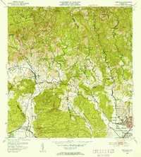
 1946 Adjuntas1946 Print · USGSAdjuntas and the surrounding central highlands are captured here in the mid-forties, showing a landscape defined by coffee and sugar estates. Researchers can trace the heritage of specific estates like Hacienda Jauca and Hacienda El Progreso or locate mountain landmarks such as Cerro El Gigante.2 unique versions available
 - 1947 Map of Ponce NE
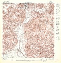
 1947 Ponce NE1947 Print · USGSJuana Díaz and the surrounding highlands are captured in the mid-1940s, showing a landscape defined by historic agricultural estates and river valleys. Researchers can trace family sites at Poblado Collores and Poblado Margarita or locate landmarks like the Guayabal Escuela.
 - 1947 Map of Playa De Ponce NE
 1947 Playa De Ponce NE1947 Print · USGSThe southern coast of Puerto Rico is captured here in the 1940s, showing the height of the sugar industry between Ponce and Juana Díaz. Genealogists and historians can locate family estates like Hacienda Cintrona Segunda and the industrial complexes at Central Boca Chica or trace the shoreline to the Faro on Isla de Muertos.
 - 1947 Map of Punta Gughara NE
 1947 Punta Gughara NE1947 Print · USGSThe southern coast of Puerto Rico is captured here in the late 1940s, showing the agricultural and maritime character of the area around Ponce. Researchers can trace the layout of Hacienda Matilde, locate the coastal Faro, and explore the wetlands of Laguna de las Salinas.
 - 1947 Map of Penuelas NE
 1947 Penuelas NE1947 Print · USGSThe rural highlands of Ponce and Peñuelas are captured here in the mid-1940s, showing a landscape of deep valleys and mountain estates. Researchers can trace local heritage through the Escuela Segunda Unidad de Corral Viejo and family-named lands like Hacienda Burenes.
 - 1947 Map of Ponce SO
 1947 Ponce SO1947 Print · USGSPonce's urban core and surrounding agricultural estates are captured here in the late 1940s as the city expanded toward the foothills. Local researchers can locate family landmarks like Hacienda Ana Maria, the Central Mercedita sugar mill, and the American Railroad.
 - 1947 Map of Ponce SE
 1947 Ponce SE1947 Print · USGSJuana Díaz and the surrounding agricultural plains of southern Puerto Rico come to life in this detailed postwar survey. Genealogists and historians can trace the foundations of local families at named estates like Hacienda Cristal and Hacienda Teresa or follow the historic Ponce and Guayama RR rail line.
 - 1947 Map of Jayuya SE
 1947 Jayuya SE1947 Print · USGSThe high interior of Puerto Rico is captured here in the 1940s, showcasing the agricultural and hydroelectric development across the Cordillera Central. Researchers can locate historic family estates like Hacienda El Semil and trace the early power grid at Planta Hydroelectrica Toro Negro No 2.
 - 1947 Map of Adjuntas SO
 1947 Adjuntas SO1947 Print · USGSThe mountain town of Adjuntas and the high peaks of the Cordillera Central are shown here in the late 1940s. Genealogists and historians can trace old property lines along the Río Grande de Arecibo or locate landmarks like the Adjuntas Chimney and Lago Garzas.
 - 1947 Map of Penuelas NO
 1947 Penuelas NO1947 Print · USGSThe high peaks of the Puerto Rican interior are captured here in the late 1940s as hydroelectric power transformed the region. Researchers can trace the early energy grid at Salto Garzas or locate family roots in mountain communities like Mata de Plátano.
 - 1947 Map of Penuelas SO
 1947 Penuelas SO1947 Print · USGSThe southern coast of Puerto Rico appears here in the mid-forties, showing the transition from steep highlands to coastal sugar lands. Researchers can trace the American Railroad of Porto Rico as it passes near Hacienda Dolores and the settlement of Tallaboa.
 - 1947 Map of Jayuya SO
 1947 Jayuya SO1947 Print · USGSThe peaks of the Cordillera Central dominate this mid-century topographic survey as it documents the borderlands of Ponce and Jayuya. Genealogists and local historians can trace the historic estates of Hacienda Carmelita and Hacienda Santa Rosa along the banks of the Rio Inabon.
 - 1947 Map of Punta Gughara NO
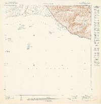 1947 Punta Gughara NO1947 Print · USGSThe southern coast of Puerto Rico during the 1940s is captured here, showing the intricate shoreline and offshore islands. Local history enthusiasts can locate coastal landmarks like Cayo Caribe and the mouth of the Rio Tallaboa near Peñon de Ponce.
 - 1947 Map of Penuelas SE
 1947 Penuelas SE1947 Print · USGSCoastal and highland Puerto Rico meet in the 1940s near the western edge of Ponce and the Peñuelas border. Researchers can trace the legacy of the American Railroad and find landmarks like the Escuela Industrial de Niñas.
 - 1947 Map of Adjuntas SE
 1947 Adjuntas SE1947 Print · USGSThe high peaks of the Cordillera Central come alive in this post-war survey of the Ponce and Adjuntas borderlands. Genealogists and historians can trace the legacy of old agricultural estates like Hacienda El Banco and the Iglesia de San Patricio.
 - 1947 Map of Playa De Ponce NO
 1947 Playa De Ponce NO1947 Print · USGSThe south coast of Puerto Rico is shown in the mid-1940s as an engine of the sugar industry and maritime trade. Genealogists and researchers can trace family lands at Hacienda Reparada or follow the shoreline from the Muelle de Ponce to Pta Cabullón.
 - 1947 Map of Ponce NO
 1947 Ponce NO1947 Print · USGSThe agricultural valleys north of Ponce are shown here during the late 1940s, highlighting the region's prominent hacienda system. Genealogists and historians can locate established estates like Hacienda Arbona and Hacienda Usera or the residential Poblado Cerrillos.
 - 1952 Map of Playa De Ponce
 1952 Playa De Ponce1952 Print · USGSThe Puerto Rican coast near Ponce comes alive in the early fifties, showing a landscape of sugar centrales and coastal haciendas. Trace the sugar economy through Central Constancia and find offshore landmarks like the Faro on Isla Caja de Muertos.2 unique versions available
 - 1952 Map of Punta Cuchara
 1952 Punta Cuchara1952 Print · USGSThe southern coast of Puerto Rico appears here at mid-century as a landscape of coastal railroads and colonial estates. Local historians can trace the Porto Rico American Railroad and identify old sites like Hacienda Matilde and Tallaboa Poniente.2 unique versions available
 - 1952 Map of Penuelas, 1953 Print
 1952 Penuelas1953 Print · USGSPeñuelas and the southern foothills of the Cordillera Central are captured here in the early fifties during a period of industrial growth. You can trace the American Railroad of Porto Rico and locate historic estates like Hacienda Oliva and Hacienda Burenes.2 unique versions available
Showing maps 1-25 of 41
Frequently asked questions
- What are the different types of historical maps available for Ponce?
- What is the oldest map of Ponce?
- Where can I purchase historical maps of Ponce for my home or office?
- Where can I download high-res historical maps of Ponce?
- Are there historical topographic maps available for Ponce?
- Is there historical aerial imagery available for Ponce?
- Where are historical maps of Ponce sourced from?