Old Maps of Arenal, Salinas for Hiking & Exploration
Hike through history with 8 historic maps of Arenal. Explore old trails, ghost towns, and forgotten backroads — perfect for outdoor adventurers and local explorers.
- Rediscover forgotten places: Map out old mining camps, roads, and footpaths that no longer exist on modern maps.
- Layer with modern tools: Combine with LiDAR or satellite views to plan hikes through historical terrain.
- Made for exploration: Popular among hikers, overlanders, and local history lovers.
Use these maps to find adventure and explore the hidden past of Arenal.
Arenal, Salinas maps
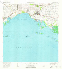
(8)- 1945 Map of Salinas
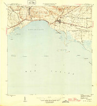 1945 Salinas1945 Print · USGSThe southern coast of Puerto Rico comes alive in this mid-century survey of the sugar-driven economy and maritime geography. Genealogists and historians can trace the legacy of local estates like Hacienda Margarita and the industrial hub at Central Caribe.2 unique versions available
 - 1947 Map of Salinas NO
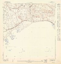 1947 Salinas NO1947 Print · USGSThe southern coast of Puerto Rico is captured here in the 1940s, highlighting the region's deep ties to coastal agriculture and the sea. Researchers can trace the layout of Hacienda Palés, the Canal de Juana Díaz, and the offshore Arrecife Media Luna.
 - 1952 Map of Salinas, 1953 Print
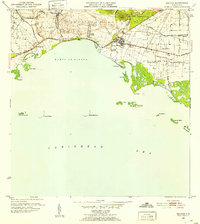 1952 Salinas1953 Print · USGSThe southern coast of Puerto Rico is captured here in the early 1950s, a landscape defined by sugar haciendas and the Caribbean shoreline. Genealogists and historians can locate family-named estates like Hacienda Pales and trace the sugar economy at Central Caribe.2 unique versions available
 - 1960 Map of Salinas, 1962 Print
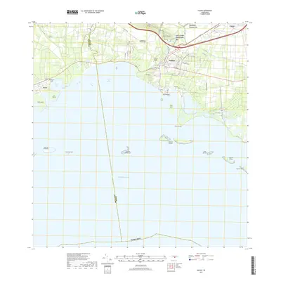
 1960 Salinas1962 Print · USGSThe southern coast of Puerto Rico is captured here in the early sixties, showing the agricultural and maritime life of the region. Researchers can trace land holdings like Hacienda Teresa or locate the mid-century Aeropuerto de Salinas.2 unique versions available
 - 1970 Map of Salinas, 1972 Print
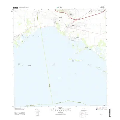
 1970 Salinas1972 Print · USGSThe southern coast of Puerto Rico is captured here in the early seventies, detailing the transition from mountain foothills to the Caribbean. Trace historic family estates like Hacienda Carmen or explore coastal features like Mar Negro and the Aeropuerto de Salinas.4 unique versions available
 - 2013 Map of Salinas, 2013 Print
 2013 Salinas2013 Print · USGSCovers Arenal, including Salinas, Urb. Brisas del Everlymar, and other nearby areas
 - 2018 Map of Salinas, 2018 Print
 2018 Salinas2018 Print · USGSCovers Arenal, including Salinas, Urb. Brisas del Everlymar, and other nearby areas
 - 2024 Map of Salinas, 2024 Print
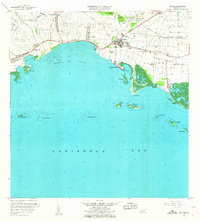
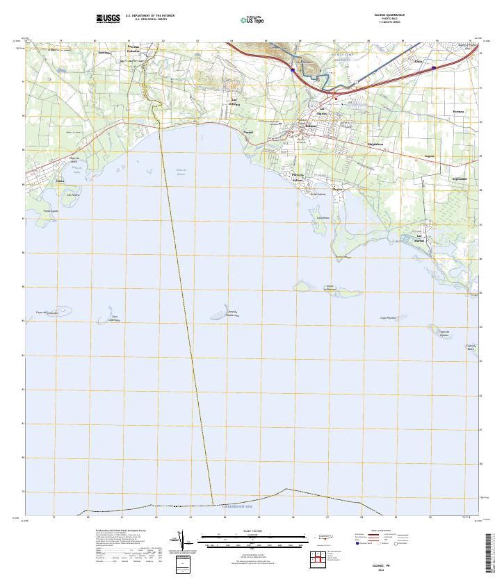 2024 Salinas2024 Print · USGSThe southern coast of Puerto Rico is mapped here in the early twenty-first century, showing the developed corridor between the mountains and the sea. Researchers can locate the Cementerio Municipal de Salinas, the military training grounds of NG MTA Camp Santiago, and coastal villages like Las Mareas.
End of results
Showing maps 1-8 of 8
Top cities near Arenal
- Guayama historical maps
- Cayey historical maps
- Coamo historical maps
- Aibonito historical maps
- Juana Díaz historical maps
- Santa Isabel historical maps
See more
Frequently asked questions
- What are the different types of historical maps available for Arenal?
- What is the oldest map of Arenal?
- Where can I purchase historical maps of Arenal for my home or office?
- Where can I download high-res historical maps of Arenal?
- Are there historical topographic maps available for Arenal?
- Is there historical aerial imagery available for Arenal?
- Where are historical maps of Arenal sourced from?