Old Maps of Coral Bay, Saint Thomas - Saint John District for Hiking & Exploration
Hike through history with 3 historic maps of Coral Bay. Explore old trails, ghost towns, and forgotten backroads — perfect for outdoor adventurers and local explorers.
- Rediscover forgotten places: Map out old mining camps, roads, and footpaths that no longer exist on modern maps.
- Layer with modern tools: Combine with LiDAR or satellite views to plan hikes through historical terrain.
- Made for exploration: Popular among hikers, overlanders, and local history lovers.
Use these maps to find adventure and explore the hidden past of Coral Bay.
Coral Bay, Saint Thomas - Saint John District maps
(3)- 1958 Map of Western St. John, 1959 Print
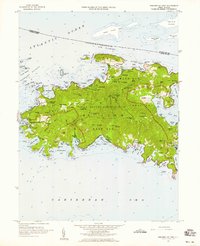 1958 Western St. John1959 Print · USGSSt. John in the late fifties shows a transition between traditional island life and the establishment of the Virgin Islands National Park. Genealogists and historians can trace family locations at Herman Farm, the settlement of Enighed, and the historic Emmaus church.6 unique versions available
 - 2013 Map of Coral Bay, 2013 Print
 2013 Coral Bay2013 Print · USGSCovers Coral Bay, including East End, Coral Harbour, and other nearby areas
 - 2024 Map of Coral Bay, 2024 Print
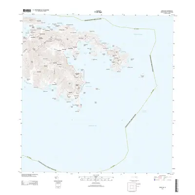
 2024 Coral Bay2024 Print · USGSSaint John’s eastern shores and the protected waters of Coral Bay are documented here in modern detail. Researchers can trace historic land tracts and heritage sites like the Annaberg Sugar Mill, Emmaus Moravian Church Cem, and Fortsberg.
End of results
Showing maps 1-3 of 3
Top cities near Coral Bay
Frequently asked questions
- What are the different types of historical maps available for Coral Bay?
- What is the oldest map of Coral Bay?
- Where can I purchase historical maps of Coral Bay for my home or office?
- Where can I download high-res historical maps of Coral Bay?
- Are there historical topographic maps available for Coral Bay?
- Is there historical aerial imagery available for Coral Bay?
- Where are historical maps of Coral Bay sourced from?