Old Maps of Prattville, Alabama for Academic Research
Study the evolution of Prattville with 50 high-resolution historic maps. Whether you're teaching, researching, or modeling changes in land use, these maps provide essential visual documentation of urban, environmental, and geographic change.
- Analyze long-term change: Track patterns in development, transportation, and natural features.
- Ideal for environmental or urban studies: Support academic projects with primary historical map data.
- Use in the classroom or lab: Educators and researchers rely on these maps to bring historical context to life.
These maps are a powerful tool for teaching, research, and visualizing how Prattville has changed over the decades.
Prattville, AL maps
(50)- 1891 Map of Clanton
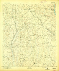 1891 Clanton1891 Print · USGSChilton and Autauga counties are shown here in the 1890s, when the river-and-rail economy defined Central Alabama. Genealogists and historians can trace the foundations of Clanton and rural landmarks like Big Spring Church, Adam's Ferry, and Ousley Store.5 unique versions available
 - 1901 Map of Wetumpka
 1901 Wetumpka1901 Print · USGSCentral Alabama at the dawn of the twentieth century was a landscape of river ferries and emerging rail lines. Genealogists and local historians can trace family-named river crossings like Knights Ferry and Nobles Ferry or early community centers such as Nixburg and Eclectic.
 - 1903 Map of Wetumpka
 1903 Wetumpka1903 Print · USGSCentral Alabama at the turn of the century remains a landscape of river ferries and emerging rail lines along the Coosa River. Genealogists and researchers can trace the early locations of Sykes Mills, Liberty Church, and river crossings like Nobles Ferry.3 unique versions available
 - 1927 Map of Montgomery
 1927 Montgomery1927 Print · USGSThe Alabama state capital and its river-bend surroundings are seen here in the late twenties during a period of growth. Researchers can trace the footprints of Maxwell Aviation Field, the Masonic Home, and rural sites like Stones Cem.
 - 1930 Map of Montgomery
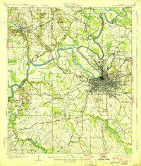 1930 Montgomery1930 Print · USGSThe Alabama state capital is seen here as a bustling rail and river crossroads in the late twenties. Trace the historic growth of the city and its surrounding rural communities through sites like Maxwell Aviation Field, Kilby Prison, and Oakwood Cemetery.4 unique versions available
 - 1953 Map of Montgomery, 1964 Print
 1953 Montgomery1964 Print · USGSCentral Alabama's river-and-rail corridor is mapped here in the mid-fifties, showing the vital connections between the capital and the Black Belt. Genealogists and historians can trace rail depots and crossroads from Marion Junction to Wetumpka, alongside landmarks like Craig AFB.4 unique versions available
 - 1956 Map of Montgomery
 1956 Montgomery1956 Print · USGSCentral Alabama in the mid-1950s shows a landscape defined by its great river systems and a booming military aviation presence. Genealogists and historians can trace the rail corridors of the Southern Railway and locate tactical bases like Maxwell AFB and Craig AFB.
 - 1957 Map of Montgomery
 1957 Montgomery1957 Print · USGSCentral Alabama in the mid-fifties is defined by the winding Alabama River and a strategic network of military bases and rail lines. Trace family roots in Montgomery and Selma, or locate landmarks like Craig AFB and the State Capitol before the interstate era.
 - 1957 Map of Autaugaville, 1958 Print
 1957 Autaugaville1958 Print · USGSThe Alabama River and the Western Railway of Alabama define the landscape of Autauga and Lowndes Counties in the late fifties. Genealogists can trace family landmarks like Yankee Town Cem, Morning Star Sch, and the rail stop at St Clair.2 unique versions available
 - 1958 Map of Montgomery, 1959 Print
 1958 Montgomery1959 Print · USGSThe state capital and its surrounding river bends are captured here during the late fifties, a period of significant military and urban growth. Researchers can trace historic institutions like Alabama State College and the extensive grounds of Maxwell Air Force Base.2 unique versions available
 - 1958 Map of Montgomery North, 1959 Print
 1958 Montgomery North1959 Print · USGSMontgomery and its northern river bends are captured here in the late fifties, showcasing a period of significant urban and military expansion. Genealogists can trace family landmarks and neighborhoods from Oakwood Cemetery to Millbrook, including rural sites like Coles Chapel and Goodship Ch.4 unique versions available
 - 1959 Map of Billingsley, 1960 Print
 1959 Billingsley1960 Print · USGSBillingsley and the surrounding Alabama countryside are captured here in the late fifties as a landscape of rural crossroads and rail-side settlements. Researchers can trace the Gulf and Ohio rail line to find Old Kingston, Vida Junction, and Locust Bluff Sch.3 unique versions available
 - 1959 Map of Elmore, 1960 Print
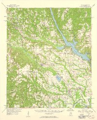 1959 Elmore1960 Print · USGSElmore County during the late fifties reveals a landscape shaped by the Coosa River and the bustling Louisville and Nashville railroad. Genealogists can trace family names at Zeigler Cem, visit the Union Rosenwald Sch, or locate the aviation footprint of the Elmore Landing Field.2 unique versions available
 - 1975 Map of Montgomery NW, 1977 Print
 1975 Montgomery NW1977 Print · USGSThe Alabama River corridor north of Montgomery shows a landscape of deep meanders and developing neighborhoods in the mid-seventies. Local historians can trace the intersection of rural land and new infrastructure along the banks of the Alabama River.
 - 1975 Map of Billingsley SE, 1977 Print
 1975 Billingsley SE1977 Print · USGSAutauga County's rural landscape is revealed in this mid-seventies aerial survey, showing the area's transition between forest and farm. Researchers can trace the layout of the settlement at Booth and follow the natural course of Bridge Creek.
 - 1975 Map of Autaugaville NE, 1977 Print
 1975 Autaugaville NE1977 Print · USGSAutauga County's riverfront and timberlands are captured in detail during the mid-seventies, showing the rural landscape of central Alabama. Genealogists and local historians can trace the roads and fields surrounding the settlement of Forester and the banks of the Alabama River.
 - 1975 Map of Montgomery North, 1977 Print
 1975 Montgomery North1977 Print · USGSThe northern reaches of Montgomery and the winding Alabama River are shown in detail during the mid-1970s. Trace the development of local settlements like Boylston and Brook alongside the dramatic river meanders and growing road networks.
 - 1975 Map of Elmore SW, 1977 Print
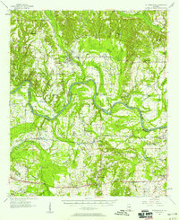
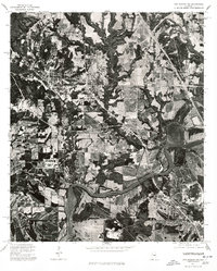
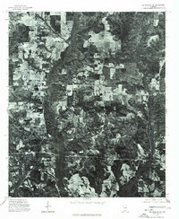
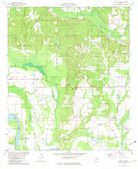
 1975 Elmore SW1977 Print · USGSCovers Prattville, including Millbrook, Pine Level, and other nearby areas
 - 1981 Map of Prattville
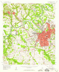
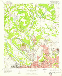
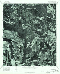
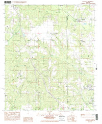
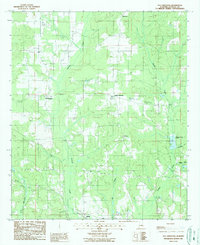
 1981 Prattville1981 Print · USGSPrattville at the start of the eighties shows a city balancing its industrial heritage with modern expansion near the Alabama River. Genealogists and historians can locate family burial sites like Doster Cem and trace the old Washington Ferry Road toward the water.2 unique versions available
 - 1981 Map of Forester, 1982 Print
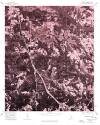
 1981 Forester1982 Print · USGSAutauga County in the early eighties centers on the riverbank communities and sprawling wetlands along the Alabama River. Researchers can trace the layout of Autaugaville and Booth, or locate family sites near DeJarnett Cem and Autauga Hill Ch.2 unique versions available
 - 1984 Map of Deatsville, 1985 Print
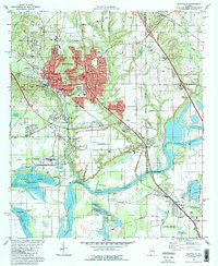
 1984 Deatsville1985 Print · USGSDeatsville and the Autauga-Elmore county line are shown in the mid-1980s as rural communities began to intersect with state institutions. Genealogists can trace family names at Holland Cem or McKeithen Cem and locate landmarks like Stoney Point.2 unique versions available
 - 1986 Map of Montgomery
 1986 Montgomery1986 Print · USGSCentral Alabama's river-and-rail corridor is captured in the mid-1980s, centered on the state capital and its surrounding rural counties. Researchers can trace ancestral landmarks like Oakwood Cemetery, military sites like Maxwell Air Force Base, and small towns such as Lowndesboro.2 unique versions available
 - 1986 Map of Clanton
 1986 Clanton1986 Print · USGSCentral Alabama’s river-driven landscape is captured here in the mid-eighties, centered on the growth of Clanton and the hydroelectric lakes of the Coosa River. Genealogists and historians can trace the Old Indian Treaty Boundary or locate landmarks like Sykes Mill and Collins Chapel.
 - 1987 Map of Old Kingston
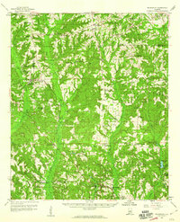
 1987 Old Kingston1987 Print · USGSAutauga County in the late eighties remains a landscape of quiet crossroads and winding waterways like Autauga Creek. Researchers can trace old family locales and rural landmarks including Old Kingston, Poseys Crossroads, and Mt Sinai.
 - 1987 Map of Clanton, 1990 Print
 1987 Clanton1990 Print · USGSCentral Alabama in the late eighties reveals a landscape of massive river reservoirs and forest reserves. Trace the rail-and-road corridors through Clanton and Wetumpka to find historic sites like Fort Toulouse and Collins Chapel.
Showing maps 1-25 of 50
Top cities near Prattville
- Montgomery historical maps
- Millbrook historical maps
- Wetumpka historical maps
- Holtville historical maps
- Pine Level historical maps
- Deatsville historical maps
See more
Top neighborhoods of Prattville
- Upper Kingston historical maps
- Willowbrook historical maps
- Dosterville historical maps
- Pate historical maps
- Fays historical maps
- Hunting Ridge historical maps
See more
Frequently asked questions
- What are the different types of historical maps available for Prattville?
- What is the oldest map of Prattville?
- Where can I purchase historical maps of Prattville for my home or office?
- Where can I download high-res historical maps of Prattville?
- Are there historical topographic maps available for Prattville?
- Is there historical aerial imagery available for Prattville?
- Where are historical maps of Prattville sourced from?