1940s Maps of Perdido Beach, Alabama
Explore 6 historic maps of Perdido Beach from the 1940s. These maps offer a rare glimpse into what life looked like during the 1940s — showing old roads, neighborhoods, homes, and landmarks that have changed or disappeared over time.
Whether you're researching your family's past, planning a metal detecting trip, or studying how Perdido Beach's landscape evolved across the 1940s, these high-resolution maps are a powerful tool for exploring the history of this region.
- Focus on a specific era: All maps on this page are from the 1940s, giving you a focused view of this time period.
- See what’s changed: Compare century-old streets, trails, and buildings to today's modern landscape using overlays and satellite layers.
- Research with precision: Use these maps for genealogy, historical research, land use analysis, or educational projects.
- View, download, or print: Maps are fully viewable online in high resolution, and can be downloaded or printed for your own records.
Start exploring Perdido Beach's history through authentic maps from the 1940s. This is your window into the past.
Perdido Beach, AL maps
(6)- 1941 Map of Fort Barrancas
 1941 Fort Barrancas1941 Print · USGSCoastal Florida and Alabama meet at the Perdido River during the early 1940s, showing a landscape of bayous, naval aviation, and growing bayside towns. Genealogists and historians can trace old homesteads near Millview, Fort Barrancas, and schools like Oakfield Sch.3 unique versions available
 - 1941 Map of Foley, 1964 Print
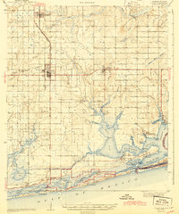
 1941 Foley1964 Print · USGSCoastal Baldwin County in the early 1940s shows the working landscape of the Gulf before the era of major development. Researchers can trace the Louisville and Nashville Railroad line, find local landmarks like Stone Quarry Bayou, and locate early community sites such as Miflin Sch.3 unique versions available
 - 1943 Map of Fort Barrancas
 1943 Fort Barrancas1943 Print · USGSThe Florida-Alabama borderlands at Perdido Bay come alive in the early 1940s, showing a landscape of coastal swamps and growing Pensacola suburbs. Researchers can trace the grounds of Fort Barrancas, locate Oakfield Sch, or find family roots near Millview and Seminole.2 unique versions available
 - 1943 Map of Foley
 1943 Foley1943 Print · USGSCoastal Baldwin County in the early 1940s shows a landscape of rail-end farming hubs and quiet bayou settlements before the rise of modern tourism. Genealogists and historians can trace local family roots through sites like Summerdale Cem, the Little Rock School, and the fishing village of Bon Secour.2 unique versions available
 - 1944 Map of Miflin
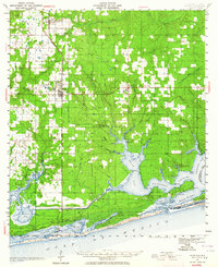
 1944 Miflin1944 Print · USGSCoastal Alabama and the Florida borderlands are captured here during the mid-forties, showing the quiet maritime life of the Gulf shore. Researchers can trace family-named points and old settlements like Josephine, Perdido Beach, and the Josephine School.
 - 1944 Map of Perdido Bay South
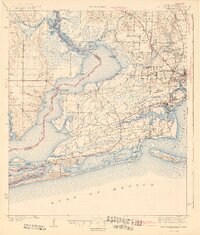
 1944 Perdido Bay South1944 Print · USGSThe Florida-Alabama borderlands at Perdido Bay were a complex of waterways and barrier islands during the 1940s. Genealogists and maritime historians can trace old coastal landmarks like the Pontoon Swing Bridge, Perdido Beach, and the Old River.
End of results
Showing maps 1-6 of 6
Top cities near Perdido Beach
- Foley historical maps
- Gulf Shores historical maps
- Orange Beach historical maps
- Robertsdale historical maps
- Elberta historical maps
- Summerdale historical maps
See more
Frequently asked questions
- What are the different types of historical maps available for Perdido Beach?
- What is the oldest map of Perdido Beach?
- Where can I purchase historical maps of Perdido Beach for my home or office?
- Where can I download high-res historical maps of Perdido Beach?
- Are there historical topographic maps available for Perdido Beach?
- Is there historical aerial imagery available for Perdido Beach?
- Where are historical maps of Perdido Beach sourced from?