Old Maps of Yupon, Alabama for Genealogy
Trace your family roots with 13 historic maps of Yupon. These high-res maps reveal old neighborhoods, homesites, landmarks, and streets — helping you uncover where your ancestors lived and how the area evolved over time.
- Explore historic neighborhoods: Identify where your relatives may have lived in the 1800s or 1900s.
- Compare maps over time: Trace the changes in streets, buildings, and landmarks for multi-generational research.
- Perfect for genealogy & ancestry research: Used by family historians and researchers to map out lineage and migration.
These maps are an incredible resource for exploring your personal connection to Yupon's past.
Yupon, AL maps
(13)- 1921 Map of Point Clear
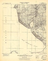 1921 Point Clear1921 Print · USGSThe eastern shore of Mobile Bay and its tidal inlets are captured here in the years following the Great War. Researchers can trace early coastal settlements like Point Clear, find family names at Seymours Bluff, and locate the historic Dixie Road corridor.2 unique versions available
 - 1941 Map of Weeks Bay, 1965 Print
 1941 Weeks Bay1965 Print · USGSThe Alabama coast at the start of the 1940s reveals a world of bayous, river landings, and quiet maritime settlements. Trace family roots and local history through landmarks like Magnolia Springs, the Confederate Rest Cem, and Springhill Sch.2 unique versions available
 - 1943 Map of Weeks Bay
 1943 Weeks Bay1943 Print · USGSBaldwin County's shoreline and river systems are captured here in the early 1940s, just as the coastal landscape was modernizing. Genealogists can trace family names and local sites at Confederate Rest Cem, Magnolia Springs, and McKenzie Ferry.3 unique versions available
 - 1957 Map of Pensacola, 1967 Print
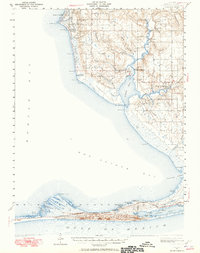
 1957 Pensacola1967 Print · USGSThe Florida Panhandle and Alabama coast are seen here at the height of the Cold War, showcasing a unique mix of military aviation and emerging beach tourism. Genealogists and local historians can trace legacy sites like Old Corry Field, the lumber town of Bagdad, and the coastal reaches of Santa Rosa Island.3 unique versions available
 - 1959 Map of Pensacola
 1959 Pensacola1959 Print · USGSThe Florida Panhandle and Alabama coast come alive in this late fifties survey of military aviation and maritime life. Genealogists can trace family roots in Bagdad, Loxley, and Milton while mapping the rails of the Louisville and Nashville.
 - 1960 Map of Pensacola
 1960 Pensacola1960 Print · USGSThe Florida Panhandle and Alabama's eastern shore are shown during a period of rapid military and coastal growth. Genealogists and historians can trace the mid-century footprints of Warrington, the Pensacola NAS (Chevalier), and the Blackwater River timber lands.
 - 1978 Map of Pensacola, 1980 Print
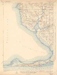
 1978 Pensacola1980 Print · USGSThe Gulf Coast at the end of the 1970s reveals a landscape shaped by maritime industry and a heavy naval presence. Researchers can trace the development of Pensacola alongside quiet coastal hamlets like Magnolia Springs and the historic Fort Pickens State Park.3 unique versions available
 - 1980 Map of Magnolia Springs
 1980 Magnolia Springs1980 Print · USGSCoastal Baldwin County is captured here in the late seventies, showing the tidal reach of Weeks Bay and the riverfront community of Magnolia Springs. Genealogists can locate family landmarks like Brook Cedron Cem, Clay City, and the Fish River Ch.3 unique versions available
 - 2011 Map of Magnolia Springs, 2011 Print
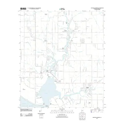 2011 Magnolia Springs2011 Print · USGSCovers Yupon, including Fairhope, Magnolia Springs, and other nearby areas
 - 2014 Map of Magnolia Springs, 2014 Print
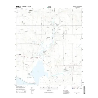 2014 Magnolia Springs2014 Print · USGSCovers Yupon, including Fairhope, Magnolia Springs, and other nearby areas
 - 2018 Map of Magnolia Springs, 2018 Print
 2018 Magnolia Springs2018 Print · USGSCovers Yupon, including Fairhope, Magnolia Springs, and other nearby areas
 - 2020 Map of Magnolia Springs, 2020 Print
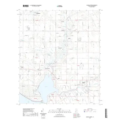 2020 Magnolia Springs2020 Print · USGSCovers Yupon, including Fairhope, Magnolia Springs, and other nearby areas
 - 2024 Map of Magnolia Springs, 2024 Print
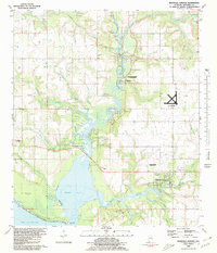
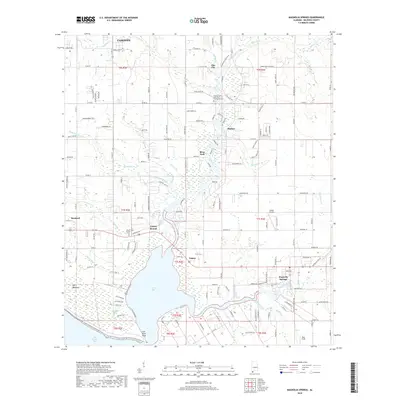
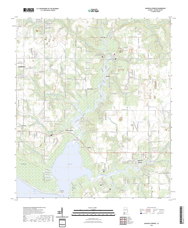 2024 Magnolia Springs2024 Print · USGSMagnolia Springs and the coastal Baldwin County river systems are mapped here in the early twenty-first century. Researchers can locate family landmarks like the Weeks Family Cem, the historic Fobbs Ferry crossing, and the Vernant Park Baptist Church.
End of results
Showing maps 1-13 of 13
Top cities near Yupon
- Mobile historical maps
- Daphne historical maps
- Fairhope historical maps
- Foley historical maps
- Gulf Shores historical maps
- Orange Beach historical maps
See more
Frequently asked questions
- What are the different types of historical maps available for Yupon?
- What is the oldest map of Yupon?
- Where can I purchase historical maps of Yupon for my home or office?
- Where can I download high-res historical maps of Yupon?
- Are there historical topographic maps available for Yupon?
- Is there historical aerial imagery available for Yupon?
- Where are historical maps of Yupon sourced from?