Old Maps of Blount County, Alabama
Explore 189 old maps of Blount County, spanning from 1885 to today. These high-resolution historic maps reveal how streets, neighborhoods, landmarks, and natural features evolved over time — perfect for genealogy, metal detecting, research, and local history exploration.
What you can do with these maps:
- See how Blount County changed over time: Compare historical maps to modern-day views to trace roads, homesites, rail lines & more.
- View detailed metadata: Each map includes creators, publishers, year, scale, and archive source.
- Overlay maps with satellite & LiDAR: Visualize the past alongside modern tools to explore terrain & human change.
- Trusted historical sources: Maps sourced from the USGS, Library of Congress, and other archives.
- Access maps your way: View online, download high-res files, or order prints for personal or research use.
Start exploring old maps of Blount County to uncover forgotten places, hidden landmarks, and the deep history beneath your feet.
Blount County, AL maps
(189)- 1885 Map of Gadsden
 1885 Gadsden1885 Print · USGSNortheast Alabama in the mid-1880s was a landscape of river-side landings and emerging rail towns. Genealogists and historians can trace the early foundations of Guntersville and Gadsden while locating rural landmarks like Hillian Store, Cottonville, and Law Landing.
 - 1888 Map of Cullman
 1888 Cullman1888 Print · USGSCullman and Morgan counties are shown in the late 1880s as the railroad fueled growth across the Sand Mountain region. Genealogists can trace early homesteads and commerce at Sobotka's Mill, Fort Bluff, and the riverside town of Blountsville.
 - 1888 Map of Gadsden
 1888 Gadsden1888 Print · USGSNorth Alabama's river valleys and plateau lands are captured here in the late nineteenth century as the region transitioned from river landings to rail transport. Researchers can locate early post offices and commerce centers like Hillian's Store, Guntersville, and the ferry at Ft Deposit.
 - 1889 Map of Springville
 1889 Springville1889 Print · USGSSt. Clair County and its neighbors are mapped here during the late Victorian era as railroads began to transform the old plantation and river economy. Genealogists can locate family landmarks like Henry's Mill, trace the path of Jackson's Trace, or find the location of old river crossings at Colman's Ferry.
 - 1889 Map of Birmingham
 1889 Birmingham1889 Print · USGSIn the late nineteenth century, the Iron City was a growing urban core surrounded by intensive extraction sites and river crossings. Trace early industrial footprints at the Pratt Mines, Sloss Quarry, and the Old Irondale Furnace.
 - 1892 Map of Cullman
 1892 Cullman1892 Print · USGSNorth-central Alabama's development is centered on the railroad corridor and rugged plateau country in the late nineteenth century. Genealogists can trace family footprints at Sobotka's Mill, along the historic Stout's Road, or near the remote Newsome Sinks.4 unique versions available
 - 1892 Map of Birmingham
 1892 Birmingham1892 Print · USGSBirmingham and the surrounding iron district emerge in the late nineteenth century as a hub of heavy industry and rail expansion. Trace the early footprints of the Sloss Mine, locate river crossings like Doss Ferry, and find family-named landmarks like Hanby Mill.
 - 1892 Map of Springville
 1892 Springville1892 Print · USGSNortheast Alabama at the end of the nineteenth century is a landscape of river crossings and expanding rail lines. Genealogists can trace family footprints at St. Clair Springs, Greensport, and numerous river crossings like Colman's Ferry or Goodwin's Mill.7 unique versions available
 - 1892 Map of Gadsden
 1892 Gadsden1892 Print · USGSNorth Alabama's river-and-rail economy is captured here in the late nineteenth century as Guntersville and Gadsden emerge as regional hubs. Genealogists and historians can trace the routes of the Birmingham Mineral R. R. or locate old community centers like Cottonville and Mt Zion.
 - 1895 Map of Gadsden
 1895 Gadsden1895 Print · USGSNortheast Alabama at the close of the century was a landscape of river landings and mountain gaps where the Tennessee River met growing rail hubs. Genealogists can trace family holdings near Hillian Store, Cottonville, and the remote heights of Lookout Mountain.
 - 1895 Map of Birmingham
 1895 Birmingham1895 Print · USGSBirmingham at the peak of its industrial boom is captured here as the city’s rail and mining networks spread through the surrounding valleys. Researchers can trace early iron production at Old Irondale Furnace or locate family roots at Doss Ferry and Pratt Mines.2 unique versions available
 - 1903 Map of Gadsden
 1903 Gadsden1903 Print · USGSNorthern Alabama in the late nineteenth century centers on the busy Tennessee River corridor and its surrounding ridges. Trace old family sites and transport hubs like Hillian Store, Lovelace Landing, and the Mt Zion church.4 unique versions available
 - 1907 Map of Birmingham
 1907 Birmingham1907 Print · USGSJefferson and Blount counties are shown in the early twentieth century as the industrial heart of Alabama was taking shape. Genealogists can trace family roots through named landmarks like Box Schoolhouse, Watson PO, and the coal works at Watts Mines.5 unique versions available
 - 1936 Map of Hulaco
 1936 Hulaco1936 Print · USGSDuring the mid-1930s, this portion of northern Alabama was a landscape of mountain crossroads and rural congregations. Genealogists and researchers can trace family landmarks like Crawford Cem, Harvells Store, and local schools including Hulaco Sch.
 - 1936 Map of Arab
 1936 Arab1936 Print · USGSThe town of Arab and the surrounding ridges of Marshall and Cullman counties appear here in the mid-1930s. Researchers can trace the early footprint of the Guntersville Reservoir alongside Ellenberg's Mill and Rocky Mtn Ch.
 - 1936 Map of Brooksville
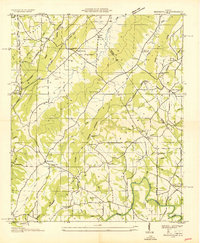 1936 Brooksville1936 Print · USGSBlount and Marshall Counties meet in the mid-1930s among the ridgelines of the Cherokee Basin. Researchers can trace the early road network of Old Tennessee State Highway No 38 to find old community hubs like Nixon Chapel and Oak Hill Sch.
 - 1936 Map of High Point
 1936 High Point1936 Print · USGSMarshall County's upland plateau is captured in the mid-1930s during a period of significant Tennessee Valley Authority activity. Genealogists and local historians can trace family locations near Hyatt, High Point, and the Rock Spring Ch along the heights of Sand Mountain.
 - 1936 Map of Holly Pond
 1936 Holly Pond1936 Print · USGSBlount County, Alabama, is captured here in the mid-1930s during the early years of the Tennessee Valley Authority. Researchers can trace the historical Old Tennessee Basin Cherokee Boundary Divide and the path of Big Spring Creek near State Highway No 38.
 - 1948 Map of Arab, 1974 Print
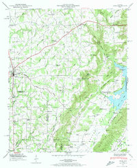 1948 Arab1974 Print · USGSMarshall County's upland plateaus and the Tennessee Valley Divide are captured here shortly after the Second World War. Researchers can trace rural lineages through sites like Johnsons Mill, Thrasher Crossroads, and the Brashier Chapel Cem.3 unique versions available
 - 1949 Map of Hulaco, 1976 Print
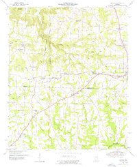 1949 Hulaco1976 Print · USGSNortheastern Cullman County and its neighboring borders are documented here in the late 1940s, showing a landscape defined by the Tennessee Valley Divide. Researchers can trace the early footprints of Joppa, Ryan Crossroads, and Baileyton, or locate rural landmarks like Hulaco Sch and Mt Oak Church.
 - 1950 Map of Arab
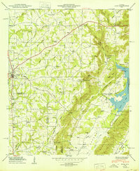 1950 Arab1950 Print · USGSThe Tennessee Valley uplands in the mid-century are captured here, centered on the growing town of Arab and its surrounding ridge-country settlements. Genealogists can trace family landmarks like Johnsons Mill, Ridgway Cem, and the rural community at Brashier Chapel.
 - 1951 Map of Arkadelphia, 1952 Print
 1951 Arkadelphia1952 Print · USGSCullman County in the early fifties shows a landscape of ridge-top settlements and winding river valleys. Genealogists can locate rural landmarks like The Colony, McDonald Cem, and the Colony School nestled between Arkadelphia Mountain and the Mulberry Fork.5 unique versions available
 - 1951 Map of Warrior, 1952 Print
 1951 Warrior1952 Print · USGSNorthern Jefferson County's mining and river corridor is captured here in the early fifties, centered on the Warrior and Kimberly communities. Genealogists and historians can locate family landmarks like the Mortimer Jordan Sch, Watts Union Ch, and the Louisville and Nashville rail line.8 unique versions available
 - 1951 Map of Creel, 1952 Print
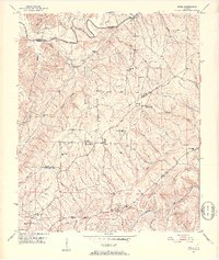 1951 Creel1952 Print · USGSNorth-Central Alabama in the early fifties was a region of high ridges and winding river forks where rural life centered on small crossroads. Genealogists can locate family landmarks at Partridge Crossroads, Red Hill Sch, and the New Zion Hill Ch community.5 unique versions available
 - 1951 Map of Blount Springs, 1952 Print
 1951 Blount Springs1952 Print · USGSThe Mulberry Fork and the Louisville and Nashville railroad defined life in these northern Alabama hills during the early fifties. Local historians can trace family locations near Blount Springs, Bangor, and Providence Ch, or locate the Blount Tunnel and Hayden High Sch.5 unique versions available
Showing maps 1-25 of 189
Top cities of Blount County
- Oneonta historical maps
- Blountsville historical maps
- Hayden historical maps
- Cleveland historical maps
- Locust Fork historical maps
- Snead historical maps
See more
Frequently asked questions
- What are the different types of historical maps available for Blount County?
- What is the oldest map of Blount County?
- Where can I purchase historical maps of Blount County for my home or office?
- Where can I download high-res historical maps of Blount County?
- Are there historical topographic maps available for Blount County?
- Is there historical aerial imagery available for Blount County?
- Where are historical maps of Blount County sourced from?