1940s Maps of Blount County, Alabama
Explore 2 historic maps of Blount County from the 1940s. These maps offer a rare glimpse into what life looked like during the 1940s — showing old roads, neighborhoods, homes, and landmarks that have changed or disappeared over time.
Whether you're researching your family's past, planning a metal detecting trip, or studying how Blount County's landscape evolved across the 1940s, these high-resolution maps are a powerful tool for exploring the history of this region.
- Focus on a specific era: All maps on this page are from the 1940s, giving you a focused view of this time period.
- See what’s changed: Compare century-old streets, trails, and buildings to today's modern landscape using overlays and satellite layers.
- Research with precision: Use these maps for genealogy, historical research, land use analysis, or educational projects.
- View, download, or print: Maps are fully viewable online in high resolution, and can be downloaded or printed for your own records.
Start exploring Blount County's history through authentic maps from the 1940s. This is your window into the past.
Blount County, AL maps
(2)- 1948 Map of Arab, 1974 Print
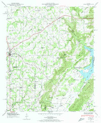 1948 Arab1974 Print · USGSMarshall County's upland plateaus and the Tennessee Valley Divide are captured here shortly after the Second World War. Researchers can trace rural lineages through sites like Johnsons Mill, Thrasher Crossroads, and the Brashier Chapel Cem.3 unique versions available
 - 1949 Map of Hulaco, 1976 Print
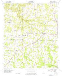 1949 Hulaco1976 Print · USGSNortheastern Cullman County and its neighboring borders are documented here in the late 1940s, showing a landscape defined by the Tennessee Valley Divide. Researchers can trace the early footprints of Joppa, Ryan Crossroads, and Baileyton, or locate rural landmarks like Hulaco Sch and Mt Oak Church.
End of results
Showing maps 1-2 of 2
Top cities of Blount County
- Oneonta historical maps
- Blountsville historical maps
- Hayden historical maps
- Cleveland historical maps
- Locust Fork historical maps
- Snead historical maps
See more
Frequently asked questions
- What are the different types of historical maps available for Blount County?
- What is the oldest map of Blount County?
- Where can I purchase historical maps of Blount County for my home or office?
- Where can I download high-res historical maps of Blount County?
- Are there historical topographic maps available for Blount County?
- Is there historical aerial imagery available for Blount County?
- Where are historical maps of Blount County sourced from?