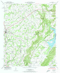
1948 Map of Arab
USGS Topo · Published 1974About this map
The Tennessee Valley Divide cuts through this landscape, separating the drainage of the Warrior Creek from the tributaries feeding into the Guntersville Reservoir. The ridge-and-valley topography of Marshall and Cullman Counties is evident in the alignment of Kelley Ridge and Ben Johnson Ridge, which flank the eastern edge of the survey. The settlement of Arab serves as a central hub, situated where U.S. Route 231 traverses the plateau.
Find a feature on this map
55 named features on this map. Tap any name to fly to it.
Don’t see what you’re looking for? This feature index may not catch every label — zoom into the map to look around manually.
Map Details
Editions of this 1948 Arab Map
3 editions found
Other maps of this area

1885 · Gadsden
USGS Topo · 1:125,000

1888 · Cullman
USGS Topo · 1:125,000

1888 · Gadsden
USGS Topo · 1:125,000

1892 · Cullman
USGS Topo · 1:125,000

1892 · Gadsden
USGS Topo · 1:125,000

1895 · Gadsden
USGS Topo · 1:125,000

1903 · Gadsden
USGS Topo · 1:125,000

1936 · Guntersville
USGS Topo · 1:24,000

1936 · Guntersville Dam
USGS Topo · 1:24,000

1936 · Hulaco
USGS Topo · 1:24,000